Earth Day continued

Friday, April 23, 2021  5 P.M.

Yesterday, I mentioned that the past 50-75 years have been the best time ever to be a human on this planet.  Currently, we have the smallest percentage of people living in poverty and hunger that Earth has ever seen.  (It would be even better if politicians were more benign.)  What has brought about this sudden, rapid improvement in worldwide living conditions?  Global warming is the primary reason.

We had some warming after World War II, then cooling during the 1970’s.  Since then we’ve had a slow warming trend –  as measured by satellites, it’s 0.14 deg. C per decade.  The Green Revolution has been a main benefactor of the warming.  Some people who study this stuff say that continued warming will provide far more benefits than harm for another 1-2 deg. C warming.  For some reason, the majority of modern environmentalists ignore the good news.

If the above is true, what’s all the “Climate Crisis” talk about?  The story begins on a hot summer day in Washington D.C.  in 1988.   Senator Al Gore and Dr. James Hansen (NASA) presented to a climate committee a scary report concerning rising carbon dioxide in the atmosphere.  In a nutshell, the message was (somewhat exaggerated) we’d better stop the CO2 increase soon or we’ll all be dead.

Perhaps there’s a clue to their intentions. The previous evening Gore and Hansen rigged the air conditioning system in the committee  room so that it would not cool that night.  Thus the room would be very warm for the hearing.work  Then, before their presentation,  they visited a rest room to toss water on their shirts, especially the underarms.  Then, as they approached the podium, they took off their suit coats to “emphasize” just how hot it was.  So, the “Climate Crisis” began as a bit of “show biz” and it still is.

A mantra came out of the committee hearing – “The science is settled.”  That wasn’t true then and it still isn’t now.  Not surprisingly, you don’t hear that statement much anymore.

The climate forecast models from the 1980’s predicted Earth’s temperature increase expected by 2020 THREE TO FOR TIMES larger than it has turned out to be.  That’s “settled” science for you.  Over the years, the models have improved somewhat.  The  Intergovernmental Panel on Climate Change (IPPC), an United Nations organization which handles this problem for the world, issued its most recent update in 2019.  (Another report is due later this year.)

The average of climate models (over 100) used for the 2019 report is now predicting a rate of warming TWICE as high as the observed temperatures.  An early look at a sample of models to be used in the 2021 report shows even higher levels of excess warming than the 2019 report.

So the models are getting closer, but are they reliable enough to spend trillions of dollars to avert a “crisis” that currently is showing no evidence of being a crisis?   Climate change is nothing new, it’s been going on forever.  What have humans been doing for the past 500,000 years when the climate changed?  They’ve adapted.  A better word is acclimated.

Brief note:  Today we pronounce acclimated as AK li ma ted.  It hasn’t always been that way.  The Webster’s I took to college  way back when said the word was  ah CLI ma ted.  Adjusted to the climate!

So what’s the problem?  Do we think the current climate is perfect?  Our announced actions seem to say “yes.”  So we’re going to re-engineer nature to keep our climate where it is?  Good luck with that.  For a huge variety of reasons (known and  unknown) Earth’s climate is always changing.  And, yes, some of that change is caused by us.  We have to do what we’ve always done – acclimate!

More next time…


Happy Earth Day

Thursday, April 22, 2021  5 P.M.

Lot’s of things have changed since the first Earth Day in 1970.  Our air is much cleaner; so is our water.  The warming of Earth has brought huge gains in agriculture and our ability to feed our rapidly growing population.  We are approaching 8 billion of us on this planet.  True, we still have 100’s of millions of underfed people, but the problem is not our ability to  raise enough food!  No, the problem is political.  (Forced starvation, after all, has been a major military tactic for eons.)

The reason we’ve been able to raise so much food was called the “Green Revolution” years ago.  Improved farming methods have helped.  But the primary reason agricultural production has increased so much so fast  is biochemistry – genetically improved crops have enabled us to feed the world.  The Green Revolution has been one of the most important aspects to our much improved living conditions worldwide over the past 50 – 75 years.

Although environmentalists (the so-called “greens”) embraced the Green Revolution at first, now it appears that a large part of the green-culture now thinks GMOs are a bad thing and should be eliminated.  To me, this amounts to “Stop GMOs…let half the world starve.”  I just can’t understand what thought process goes through the minds of anti-GMOers. Don’t they know that ever since agriculture began, farmers have been genetically altering crops through natural selection (Does the name DARWIN ring a bell?).  No crop today is anything like its ancestors centuries ago.  Genetic modification is a wonderful thing.  And now it’s gotten better since we can save many years by doing it in a lab rather than out in the fields. In essence, every crop we grow is a GMO.  Maybe the anti-GMO folks should chew on that for awhile.

The Earth Day environmentalists have gone awry in other areas as well.  Just today, President Biden said we’re  going the cut our carbon dioxide production by 50% by 2030.  There is only  one way that can happen.  Shut down the country.  You thought Covid restrictions were bad?  Wait until you see what 50% less carbon does to us.  To accomplish this task, the U.S. would go from Earth’s biggest economy to Third World status in just nine years!

Even a more realistic goal to cut carbon 50% by 2050 can only be done by  switching our power source to nuclear.  Yes, nuclear.  I know that’s a dirty world in the U.S. and especially to environmentalists, but keep in mind no one in the U.S. has ever died from a nuclear power plant accident.  How does that compare to deaths in the coal, oil and gas industries?  And modern reactors are smaller, mostly underground and highly reliable.  It’s definitely the way to go.

Continued tomorrow…


From 70 degrees to snow in 12 hours?

Tuesday, April 20, 2021  6 P.M.

It could happen tonight!

Our weather has been pretty dull lately.  Dull in the sense that not much “weather” has been nearby.  So most of April has been quite pleasant.  The absence of typical stormy Spring weather has allowed a great opportunity to see more of nature’s awakening beauty.

But, tonight’s weather could be highly unusual.  A small, but very cold, upper air system will drift over us tonight.  It’ll bring along a pocket of colder air behind a developing cold front.  That will provide enough lift to squeeze some moisture out of the atmosphere.  It won’t be much (less than a quarter inch) and won’t last long (from about 10 P.M. to 4 A.M.).  However, the upper level cold air will produce snow.  The big question will be “How soon will the surface cold air arrive.” At onset, the snow will be melted by the currently mild air so we’ll see rain.  The rain will help cool (by evaporation) the low-level temperatures.  That, along with the colder air advancing into our area, will create rapidly falling temperatures.  By about 2 A.M. temperatures should drop into the upper 30’s.  Then, the colder air will slow the melting process.  Basically, the smaller snow flakes will melt while the larger flakes should be able to make it to the surface before completely melting.  Over the next two hours temperatures may drop another degree or two, so at times it may become only very wet snow.  Then, by 4 A.M.  the steady rain/snow will move east of our area.

Snow accumulation?  Not likely on the ground or roadways.  However, some tree limbs, rooftops and cars/trucks could see small accumulations.

Then we’ll have a couple of unseasonably cool days before Spring returns.

Stuff

36 degrees is the 50%-50% temperature for rain and/or snow. Above 36 the odds rapidly favor rain.  Below 36, the odd rapidly favor snow.

Guns:  Since 1975, guns have been responsible for  the death of 1.5 million Americans. Since the Revolutionary War, about 1.4 million Americans have died in all U.S. wars and conflicts.  (Seems like our “well armed militia” is better at killing Americans than enemy combatants.)  Does anyone see a problem here?


Strong Spring Storm in the area

Thursday, March 25, 2021  5:30 P.M.

Lots of wind, possibly strong storms

The atmosphere is certainly in a severe storms state.  Moisture rushing northward and really strong wind fields to work with.  That’s pretty much the story from the deep south to the Great Lakes region.  But, I’ll try to pin things down to more detail.

The easiest part of the forecast is the location of the worst weather.  Severe thunderstorms and tornadoes are likely over a large part of the south – eastern MS, northern half of AL and most of TN are the primary spot for damaging storms.

Next, northeast MO, southeast IA and northern IL and IN are likely to see  heavy rain and, especially, very strong winds.  These will not be thunderstorm wind gusts.  The combination of storm development and upper level winds will combine to generate sustained winds over 40 mph with gusts over 60 mph for several hours tonight.  I wouldn’t be surprised if a few reports of gusts over 70 mph are measured.

So, I guess the good news is that the worst weather conditions expected tonight will be either considerably north or south of the Ohio River.  But, what happens to that space in between?  That’s us.

The Storm Prediction Center has the western half of Kentucky and southwest corner of IN  (and others) in a Tornado Watch until Midnight.  They expect a line of strong to severe thunderstorms to develop just east of the Mississippi River during the next hour or so.  They expect intensification of the line as it sweeps eastward toward us.  Primary threat time for the Louisville area will be 9 P.M. until 11 P.M.   They say severe storms are likely and some tornadoes are expected, especially over the western third of KY and TN.

Most forecast models are downplaying this line of storms for central KY and southern IN.  We’ll have to keep an eye out to see how things evolve over the next few hours.  The models suggest the instability will remain quite low tonight.  If that is correct, we’ll see a quick-hitting line of gusty thunderstorms tonight, but no major problems.

However, a different problem could create troubles for a few hours after Midnight – strong winds!  Several  paragraphs above I mentioned the non-thunderstorm winds likely northwest of us this evening.  Well, as the surface storm center moves across Indiana this evening, the door opens for the northwesterly winds behind the system to rotate southeast into our area.  We’ll see about 4-6 hours of wind gusts above 40 mph here and probably over 50 mph over southern IN.

Note to storm watchers

We expect to see a relatively narrow line of rain/thunderstorms to cross the area during the evening.  Severe storms will likely be embedded in this line, especially to our west.  If, however, if you see any “discrete” cells of thunderstorms, WATCH OUT.  These stand-alone single cells can be very dangerous in situations like this.  The strongest tornadoes almost always are produced by these rapidly moving discrete cells.  It is not too uncommon for very intense dynamics (the strong wind fields) to overcome a weak moisture supply.  The next six hours could become very interesting.

A PREDICTION:  A Severe Thunderstorm Warning will be issued for Jefferson County KY later this evening.  (When is the last time you remember when a storm Warning has NOT been issued for Jefferson County as a line of strong thunderstorms passes through?   Yep, I can’t remember either. )

Rainy weekend – mostly at night

5 P.M.  Friday, Feb. 26, 2021

Two upper air disturbances will float over the Ohio Valley this weekend.  The weaker one we’re seeing now.  Mostly light showers will be scattered over the area this evening…ending after Midnight.  Tomorrow will be warmer with mostly cloudy skies pushing temperatures into the mid 60’s.  The second system will have more moisture and energy, heavier rains will be likely tomorrow night into Sunday morning.  Our area should expect over an inch of rain with warm temperatures tomorrow night.  Temperatures remain warm Sunday.

This time no major storm development is expected, so no major surge will move in as the rain stops, so temperatures should remain seasonably mild early next week.  The average high temperature in early March is in the lower 50’s.

I have seen the future…and it is here.  part 2

The recent ice storm disaster in Texas has been used as quite a political tool for various ideologies.  The right blames solar and wind power problems (partly correct).  The left blames fossil fuel problems (partly correct).  Many say the state-run power network was the cause (big contributor).  Still others blame climate change (probably not – ice storms in Texas have a long history).  Actually, many factors combined to make a situation far worse than it should have been.

Most at fault is the government of Texas.  To allow the statewide power grid to reach the ridiculous situation that exists there today is a wonderful example of political corruption based on money rather than the public good.  It’s a rag-rag operation of little operators with little coordination.  It’s like one of those dominoes creations where you tip over one domino and hundreds  (or thousands)  more also tip over.

In recent years, a push toward solar and wind power generation has been established.  Today that produces roughly 10-11% of Texas’s total power input.  Wind and solar are unreliable because sometimes the wind doesn’t blow and the sun doesn’t shine.  But losing just 10% of your power supply shouldn’t do much damage to the overall grid.  Most of the power comes from good old fashioned power plants using either coal, oil or natural gas.  Texas also produces some nuclear power.  In recent years, for environmental concerns, coal and oil plants have been phased out along with nuclear power.  The use of natural gas, the cleanest fossil fuel, has been growing rapidly.  Okay, most states are doing the same thing, so what went wrong?

In the push to increase natural gas usage and build wind and solar facilities, something has been either forgotten or neglected, or both.  Infrastructure!  No repairs. No updates.  No improvements to existing equipment.  The existing infrastructure has been falling apart.  In a crisis they can’t ask neighboring states to sell them some extra power (state law).  So, when a crisis hits -usually winter storms and summer heat waves – they are stuck.

The way things are going, the power situation in Texas will get far worse before it gets better.  The best thing they can do to clean up their power mess is to build nuclear power plants.

Texas is not alone in this rush to “clean energy.”  Many other states are losing their energy independence.  More on that on part 3.

Early Spring weather

Tuesday, Feb. 23, 2021  4 P.M.

Weather patterns certainly have changed since last week.  Rather than ice, snow and 20’s we’ve jumped to mostly sunny and 50’s.  This trend is expected to persist for quite a while.  The circumpolar jet stream vortex that dipped south over Canada and central U.S. has retreated toward the pole and reformed westward.  The result has been a return to the “west coast trough, east coast ridge” pattern that has dominated most of our winter.

For the next few weeks (or longer), major storms will move into the western U.S. then move northeast into the central and eastern U.S.  That major storm track will bring plenty of rain to the central part of the country, including the Ohio Valley.  It also threatens to give an early (and widespread) start to the severe weather season.

I have seen the future…and it is here! (Part 1)

My apologies to whoever first uttered those words, but it seemed to fit.

The Texas ice storm has been quite a catastrophe.  The media seems so surprised by the ice storm – acting like it’s never happened before.  In fact, if anyone chose to check, a major ice storm hits Texas about once every eight years.  Ice storms are a known, expected, but rare, event.  The most recent serious ice storm was in 2011.  In fact, since 1973, six major ice storms have hit Texas.  After each one, committees were formed to make suggestions about how to better prepare for the next one.  After the first five storms, the recommendations were largely ignored.  Why? Cost.   (We’ll continue to hold together our deteriorating infrastructure with baling wire and duct tape and hope that it doesn’t happen again.)  But it always does.  I don’t imagine it’ll be any different this time.

We’ve heard many “reasons” for why the problems occurred.  Every “cause” has a different reason for the disaster.  Next time, we’ll take a look at the “blame game.”

Stuff

Recently in Washington state,  police arrested a man for carjacking. He had been released from prison just 20 minutes earlier.

Caution:  If you’re bad at haggling, you’ll end up paying the price.

Picture

Smoke billows from Mt. Etna near Giarre, Sicily. | (AP Photo/Salvatore Allegra)
From The Week

That’s it for winter, at least for awhile

Friday, Feb. 19, 2021  4 P.M.

Warming

I have found it interesting over the years how February almost always has a period of a week to 10 days of very wintry weather.  Otherwise, it’s just the usual grey skies and gloomy scenery.  Well, we just experienced our “mini-winter” and now a warm up will have us thinking of an early spring for the rest of the month.

Tomorrow will have a cold start – about 13-15 degrees – then warm to the mid 30’s.  Then about 10 degrees warmer Sunday.  Then a few days in the 50’s (possibly 60’s) next week.

Meanwhile, Tuesday’s storm dropped a sleet/snow accumulation of 4″ at the airport.  Then Wednesday night’s snowfall of 2.9″ pushed the accumulation up to 5″ at SDF.  NOTE:  Snowfall and snow accumulation are not the same. Tuesday night’s snowfall was listed as 5.5″ but the sleet/freezing rain knocked the accumulation down to 4″.  Due to some melting and settling,  the later snowfall “refreshed” the old snow/ice and boosted accumulation back up to 5″.

Snow gauge update

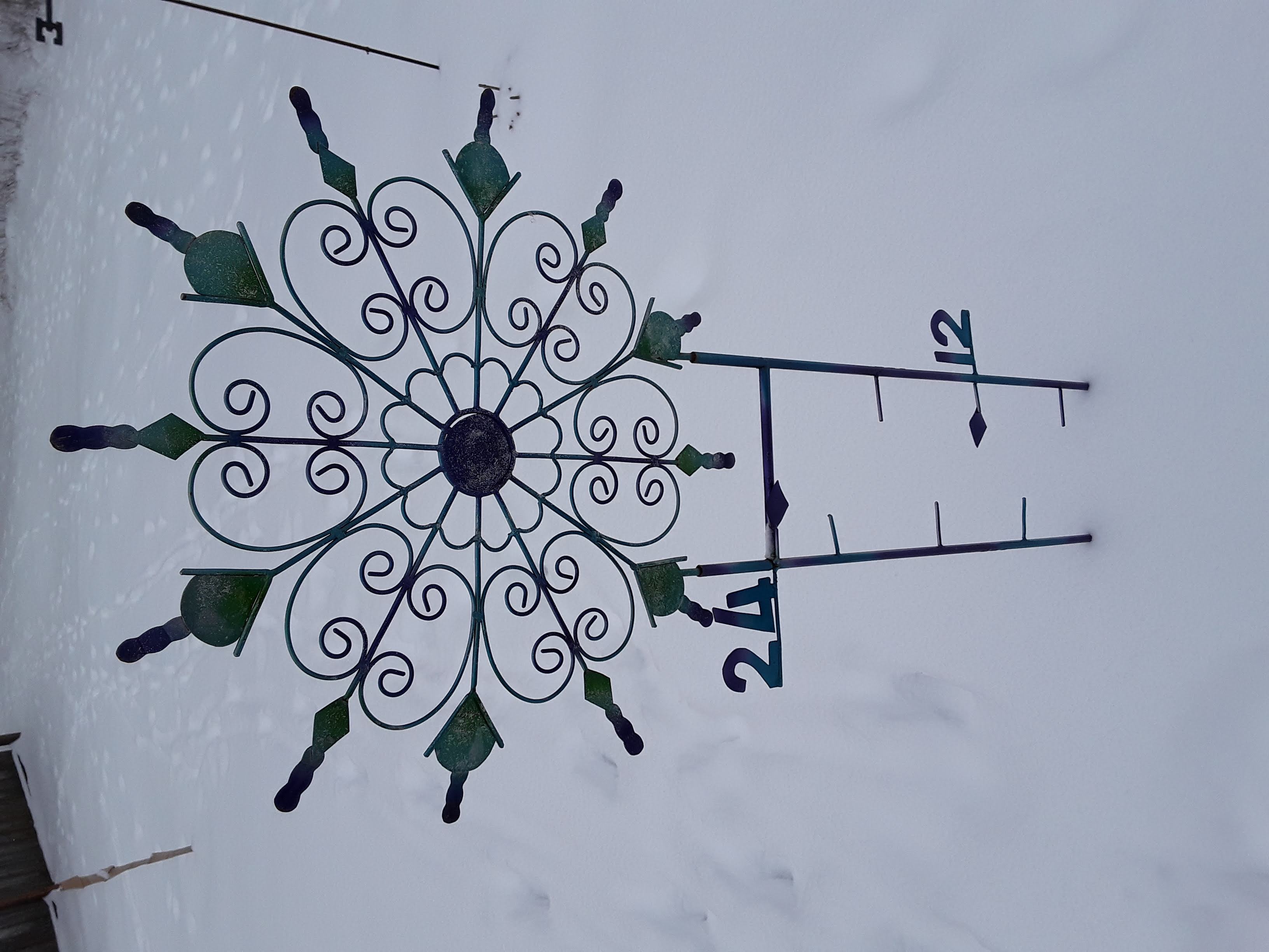
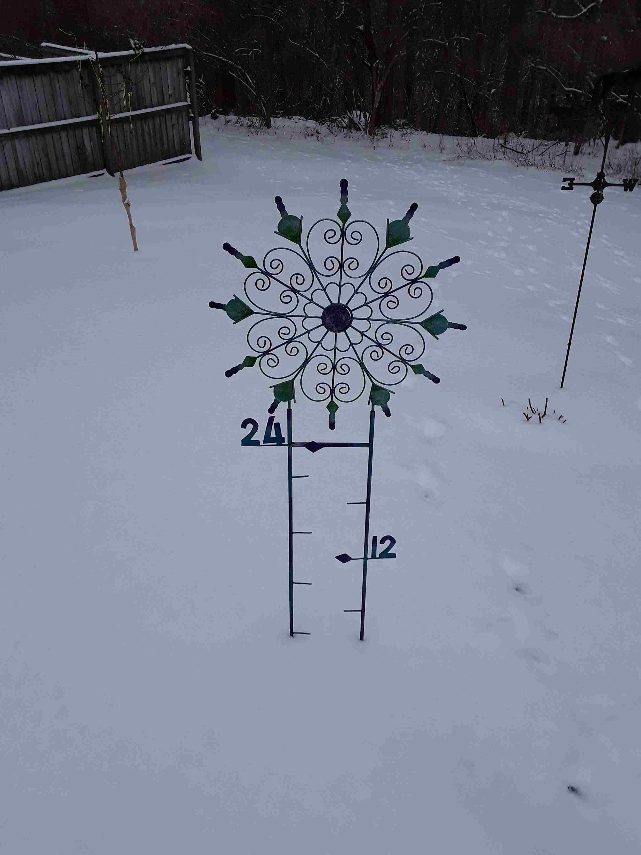
I’ve been showing pictures off my very optimistic snow gauge this week. You can go back to see them, if you wish.  The first showed just a trace of snow/ice before the expected snowstorm Monday night.  The second photo was from Tuesday morning.  It showed just under 3″.  You can see the 3″ marker line on the left side of the gauge.  Today’s photo is from yesterday morning.  About 5″ inches on the ground.


Light snow tonight

4:30 P.M., Wed. Feb.17, 2021

Heavy snow stays south and east of Louisville

The latest winter storm to come our way just can’t seem to get its act together.  Sure, there’s energy aloft and moisture available, but all the ingredients for heavy snow here are just not lining up.  Along and south of a line from Bowling Green to Lexington to Morehead, snow accumulations of 4″-6″ or more are likely.

But, we’ll be on the northern fringe of the system where the upglide (lifting motions) will be weak.  The Louisville area will get 1″-3″ of new snow.  That should break down to about 2″-3″ from Louisville into our bordering counties south and east.  Southern Indiana will have a diminishing trend from the Ohio River north and west.  Starting at about 1″-2″ near the river and dropping off to near zero 30-40 miles away from the river.

Light snow will continue tomorrow morning before fading away during the afternoon.  Little or no additional accumulation.

Stuff:

I found this little tidbit really amazing…

British mathematician Kit Yates has calculated that the estimated 2 quintillion coronavirus particles floating around the world would fit inside a single Coke can.

Meteorologists’ nightmare

Tuesday, Feb. 16, 2021  5 P.M.

Nobody likes to be wrong.  Most of us can hide mistakes so that few people, if any, know you made one.  But that doesn’t hold for operational weather forecasters.  Our mistakes are out there for everyone to see (and ridicule) while most mistakes are hidden or denied.  Yet, as a rule, meteorologists are generally well liked.  My answer to this apparent contradiction:  a meteorologist is someone who everyone can feel superior to.

While yesterday’s blown forecast was truly a whopper,  I have no excuses.  Looking back, a few clues were available, but the heavy snow seemed a far better idea.  Unfortunately, I didn’t catch on until it was too late.  Often, in times like this, you’ll hear these comments:  1) We dodged the bullet., or 2). We got lucky this time.  TRANSLATION:  I missed the forecast, but I’m not going to admit it.

Let’s try again

Another storm coming out of the southwest has the potential to be a serious snow-maker.  This time, however, we’ll be on the northern side of the heaviest snow.  Models are in pretty good agreement with this one, but nothing much will be happening until late tomorrow.  So, that gives time for adjustments.

Here’s the way it looks now:  some light snow is possible (30% chance)  tomorrow but with little or no snow accumulation.  Snow likely tomorrow night accumulating 1″-3″ by Thursday morning.  Thursday morning flurries exit area by Noon.

Stuff

Sets of “identical twins” usually do not have identical DNA genomes.  About 90% of identical twins have genome differences ranging from a few to hundreds of sequence differences.  This comes from a newly published study in Iceland.

Snow gauge photo

Not much change since Sunday: