Looks like the NAM wins!

3 P.M. Mon., Feb.15, 2021

The news is not good…for snow lovers.

The latest NAM is joined by the short range NRRR model in pushing the heavy snow range northwestward away from the Ohio River.  The NAM was the only model to “see” this change earlier, but now it appears to be correct.

The sleet that has been falling for the past hour or so has brought, to me at least, the belief that the NAM has been right.  If the sleet had been snow we’d probably already have had an inch or two.  Instead we have a thin layer of ice pellets.

So, my forecast of just a few hours ago isn’t going to happen.  We will get snow, but also sleet until about Midnight.  But the sleet will keep accumulations significantly lower than expected.

New forecast:

Louisville metro: 2″-4″

Southern IN:  up to 20 miles north of metro:  3″-5″

South of Louisville metro:  1″-2″ (mostly ice).

Stuff

Over the years, the NAM has disappointed me many times with its seemingly inferior snow/ice predictions.  Today, I should have paid more attention.


The Ohio River conundrum

 Feb. 15, 2021  1 P.M.

On the edge

It is now clear that the axis of heaviest snowfall will lie north of the Ohio.  From western KY to Evansville to Indy and on to Lake Erie will be the heaviest snow – probably a foot or more by tomorrow.

South and west of that line snow totals will diminish slowly across southern IN, then the drop off quickens from the Ohio River south and east.

As a result of this shift, some small changes must be made to my forecast.  From 10 miles north of the Ohio River and northward,  I’m sticking with 8″-12″ by tomorrow morning.

For counties right along the Ohio River, expect 6″ to 10″ of snow.  The farther south and east you are from the river, the smaller the snow totals.  South of a Leitchfield to E-town to Lexington line, it’ll be mostly an ice storm.

Important note:  

The NAM forecast system is different from the other three models I’ve checked.  It places the snow prediction about 50 miles north and west of the other models (described above).  If that proves to be closer to the actual event, the Louisville area would only get about 1″-3″ of snow plus some sleet.

Stuff

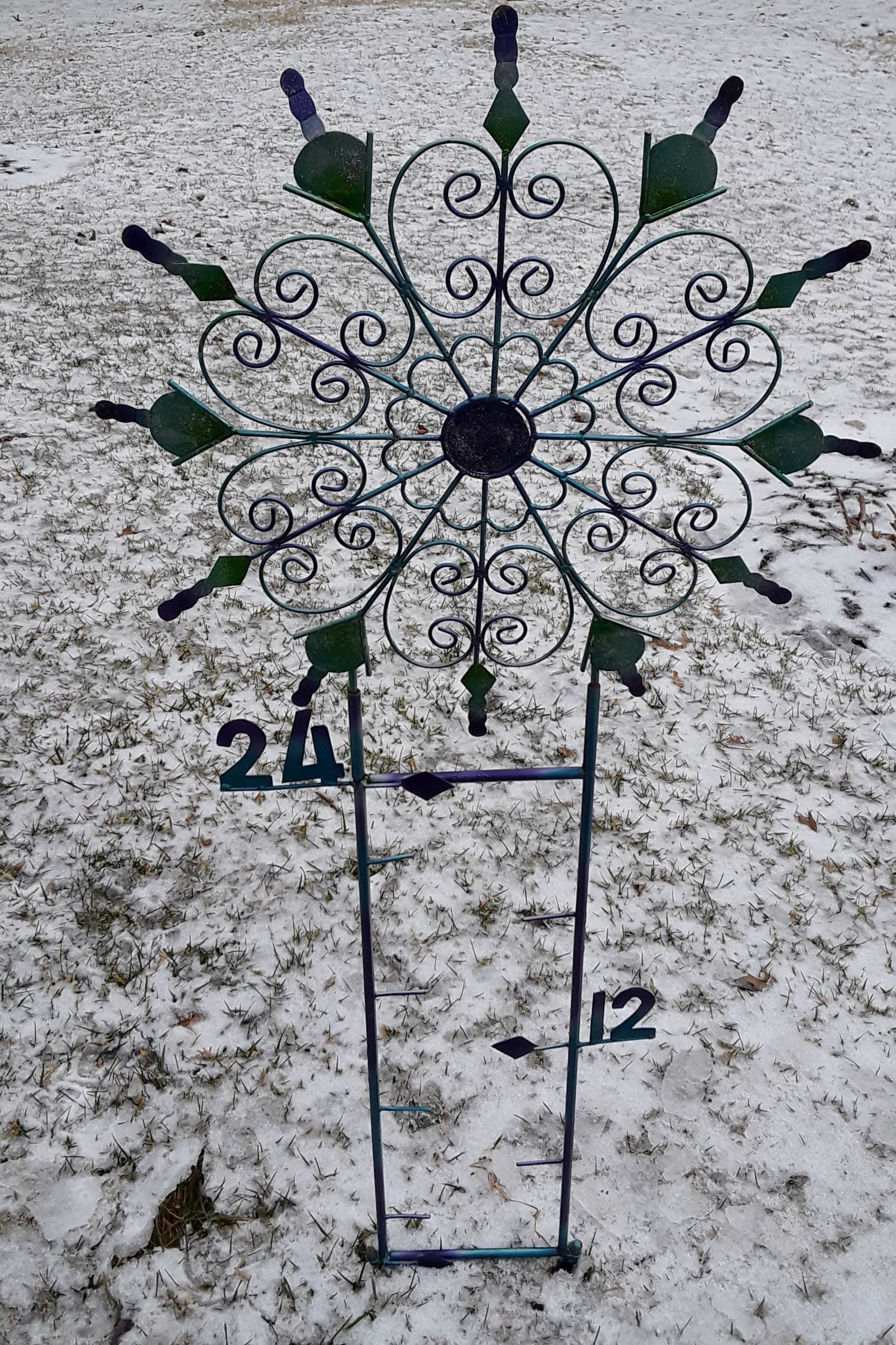
I have an unusual snow gauge.  It was given to me by one of my snow-loving daughters.

This picture is from yesterday.  I’m hoping it’ll look a whole lot different tomorrow!

Decision time

Sun., Feb.14, 2021  5 P.M.

Snow arrives after  midnight

Models continue to make a few tweaks, but even with several different opinions on surface patterns, they all seemed to have arrived at roughly the same general snow forecast for this storm coming out of the Gulf.  The upper air system seems to win out over the surface differences.  So, here goes…

An upper air disturbance ahead of the primary system will bring us snow starting after Midnight.  It should accumulate 2″-3″ by daybreak.  This system will fade out during the morning,

Then the primary system arrives during the afternoon with periods of moderate-to-heavy snowfall for about six hours.  Light snow should then fade away by Midnight.

Total Snow Accumulation:  8″-12″       Would not be surprised to see some areas get more than a foot of snow, especially north and west of Louisville.


Snow chances getting higher

6 P.M. Sat., Feb 13, 2021

Models in closer agreement

Another day without sunshine and we probably won’t have much, if any, tomorrow.  Temperatures will probably remain in the 20’s all day.  But after that, snow enters the picture.  A  strong upper air system over the southwest today will cross the Rockies tonight and become better organized south of the Texas coast by late tomorrow.  Then it heads northeastward.  What the final path will be is still uncertain, but we should have a better idea tomorrow.

Currently, the GFS predicts a 4″-6″ snowfall for our area – higher over eastern KY.  The NAM has a 6″-8″ prediction.  Snowfall should begin before the Monday morning rush hour and continue through the day.  There is disagreement about when the snowfall ends.  Estimates run from Monday evening to Tuesday morning.  The longer duration of snowfall most likely would produce an even higher snow total.

The second storm expected next week has undergone more model changes.  Best guess now favors a freezing rain to rain scenario on Thursday.

Some doubt

Although at least some snowfall is likely Monday, the amounts are uncertain.  While most of the U.S. models are big on snow, the Euro, Canadian and Navy models carry everything farther east.  As a result, our snowfall totals would be much lower.

For now, I’ll go with a forecast somewhere between the two major themes  Let’s say something like 2″ – 4″ for the Louisville area.  Either way, higher snow totals east of Louisville, especially east of I-75.

I’m hopeful I’ll have a better handle on this tomorrow.

Precip. fades away overnight

11 P.M. Wed., Feb 10, 2021

Heaviest precipitation has moved south and east this evening and will continuing moving away early Thursday morning.  All snow (by that time) will be gone before daybreak.  Less than an inch of snow on top of the ice.

Freezing rain has mostly given way to sleet locally and that will change to mostly snow in a few hours.  But not much of either.

Thursday will be dry, but cloudy and cold so not much melting will occur.

Icy night ahead

Wed. Feb.10, 2021  6 P.M.

Biggest ice threat stays south of Louisville

Situation is playing out pretty much as discussed yesterday. Freezing rain will be the biggest concern for the Louisville area tonight, but sleet will mix in at times.  Primary precipitation will be over before Midnight, but a few periods of  light sleet and or snow will hang around until daybreak.  Any accumulations will be very small. In addition, ice accumulations (.1″-.2″) will fall short of the damaging range.

Southern Indiana will see an earlier end to the icy mix and, compared to Louisville, will have less freezing rain, sleet and snow.

Biggest concern remains the central third of KY.  (Far southern and SE Kentucky now appear to have a much reduced icing threat than mentioned yesterday.)  The central third – E-town, Leitchfield, Lebanon, Bardstown, Frankfort, Lexington, etc – will see freezing rain tonight continuing at least until Noon tomorrow.  Ice accumulations should run  .25″ to .50″.  That much ice can do a lot of damage to power lines and trees/shrubs.

Snow?

Earlier this week I mentioned how the GFS model seemed to be so much different from other models when it predicted more than a foot of snow on the ground here on Sunday.  Since then, the GFS has come into closer agreement with other models, but not total agreement.  The big Sunday “snowstorm” for the Ohio Valley  has disappeared from the GFS.  It never existed on other models.

Now the GFS is predicting a major winter storm to hit the Ohio Valley Monday night – significant snow possible!  Other models are also “seeing” this storm, but are moving it northward along the eastern side of the Appalachians.  That would only give us minor problems, if any.  The GFS pulls the storm up along the western side of the mountains.  That brings back memories of January 1978.  Could it happen again?

Stuff

Bob Gibson, the Hall of Fame pitcher for the St. Louis Cardinals who recently died,  played a season with basketball’s Harlem Globetrotters before moving to baseball full time.

6:15 update

Just saw the NWS forecast. WOW!!!


Models still can’t agree

Tue., Feb 9, 2021  6 P.M.

Storm potential downgraded

Models are still having a debate at how the upcoming wintry weather system will play out.  In the short term a solution seems to be stepping forward.  But the GFS is still out on its own for the weekend.

Meanwhile, the models seem to be converging on an idea that the ice storm expected tomorrow will have its major impact over the southern two-thirds of KY.  Louisville area will have just a small amount during the day, but could see an increase in intensity tomorrow night.  I was happy to see the Weather Service downgrade Louisville’s threat assessment.  Outside of ever-slippery bridges/overpasses, tomorrow shouldn’t be too bad.  Even fewer problems over southern IN.

As colder air continues to slide southward, warmer air aloft will melt any snow trying to fall, so most of us will see freezing rain (some sleet also possible) probably beginning by mid morning.  Daytime heating should keep most of the roads wet with icy spots on the aforementioned bridges and elevated spots.  Wires, tree limbs, railings, sidewalks will probably get icy.  Luckily ice accumulations will be less than .1″

Freezing rain should pause during the afternoon, but resume again tomorrow night.  Once again, accumulations of ice should be small locally.  Also, the freezing rain should change to snow early Thursday.  Snow could accumulate an inch or two.

Although icing conditions are expected to be minor locally, this will be a MAJOR ice storm for the southern two-thirds of Kentucky.  Damaging ice conditions could accumulate to as much as .25″ to .50″.  That would be very damaging.


Week of wintry weather

Mon., Feb. 8, 5:30 P.M.

Snow, sleet, freezing rain, and rain all likely this week

1).  The GFS model predicts we’ll have over 12″ of snow on the ground by Sunday afternoon.

2).  No other model has a prediction scenario anywhere near the GFS  ideas.

3).  We’ll see several chances for a variety of precipitation types this week…tonight, Wednesday into Thursday and Sat/Sun.

We’ll take a look at tonight and save the rest for later.  A weak upper air disturbance will pass over the region tonight and the Ohio River seems to be about the dividing line between rain/snow.  The Louisville area will be on the southern edge of the system.  We’ll most likely see some light rain/snow mix beginning late this evening.  The system will be bringing colder air, so a change from rain to snow should occur later tonight.  By morning, another light accumulation is likely.  Less than one inch here with even less snow south of town.

Meanwhile, over Indiana it’ll be mostly snow and more of it.  As you travel north of I-64 in IN and about 10-20 miles north of Louisville and north of eastern Oldham Co., Trimble and Carroll Cos., you’ll see rapidly increasing amounts of snow. Most of southern Indiana can expect 1″ to 3″ of snow by morning.  That 1″-3″ total also holds for northeastern KY.

Currently, Wednesday’s storm looks like it’ll be mostly ice.  More tomorrow.

Another little snow tonight

Sat.,Feb. 6,2021  5:30 P.M.

Another weak upper air disturbance system crosses the Ohio Valley tonight.  Once again, the Gulf is cut off from the flow, so producing much moisture will take a valiant effort from the upper air contribution.  It doesn’t appear likely to happen.

As a surface cold front pushes through overnight, it’ll probably produce some flurries and snow showers for a few hours, especially around Midnight.  Models are in agreement that one-half inch accumulation (on grassy areas) should be the upper limit.  So, not much to hope for.

Colder tomorrow with a high near 30.

The “big Blast” of cold air is still on track for next weekend.  Sat/Sun should be very cold followed by a quick warming.  Current GFS says this should be a one-time deal with no significant follow-ups expected.

Stuff

Popular myth says that sharks can detect one drop of blood in an Olympic-sized swimming pool. NOT TRUE   While sharks, and fish in general, have good smelling abilities, they don’t came anywhere close to that claim.

Another popular shark myth is that once they get a taste of human blood, they will continue to search for more humans.  These are called “rogue sharks.”  Research, however, has shown that there are NO rogue sharks.  They much prefer a seafood diet.

Don’t believe everything you hear on “Shark Week.”

Waiting on the cold air

Friday, Feb. 5, 2021  4:30 P.M.

Models keep delaying arrival date

Early this week the forecast high for Super Bowl Sunday (Feb. 7) for Louisville was 20 degrees.  Now the forecast is 32 deg. Yes, that’s cold.  But around here a high of 20 is quite a different situation.  So, what’s going on?

What’s going on is a common habit of the GFS model.  It (often) foresees a major pattern change or shift, but predicts it to happen too soon.  Such is the case this time.  Originally, the GFS brought the bitter cold air into the Ohio Valley tomorrow.  By midweek, the big arrival was pushed back until next Wed/Thu with only a small chunk of the colder air arriving Sunday.

Current thought is that another small surge of wintry air arrives about Tue/Wed.  Finally, the much anticipated “coldest air of the winter” makes it’s appearance Fri/Sat.

With the “Big Chill” still a week or so away,  the smaller air masses will still keep us in below normal temperatures next week.  Daytime highs will run from the upper 20’s to the 30’s.  Several weak upper air systems will probably bring some more small snows during that time.  The first chance will be tomorrow night into early Sunday.  Then, very light snow/flurries should be an almost daily occurrence next week.  Best chance for meaningful snowfall will be with the really cold air arrival late next week.