Monthly Archives: September 2014

Rainy night ahead

Wednesday afternoon

A cold front is approaching and this one appears to be in considerably better shape than the last one.  This time, the upper and lower levels are cooperating a little better and their looks like more moisture is available.  The only negative I see is the timing.  Nighttime, especially late night, is not a good time for thunderstorms this time of year.  And, since we didn’t get nearly as much heating as expected today thanks to the clouds, any thunderstorms we get tonight should not pose much of a threat.

One thing that has changed, however, is the timing.  Recent trends now point to the best time for the showers/thunderstorms to arrive in our area to be between 10 P.M. and 4 A.M.  After that any lingering showers should fade/move away by 8-9 A.M.  Cooler air will slowly filter in tomorrow and with mostly cloudy skies we’ll probably stay in the upper 70’s.

Temperatures will stay just a little below normal through Friday, but another cold front will reinforce the cold air with a chilly day Saturday, then a quick bounce back starting Sunday.

Rainfall tonight.  Models and forecasters are still sticking with a pretty heavy rainfall tonight.  And those areas that receive a strong thunderstorm tonight could see an inch or more of rain in a few hours.  However, it is unlikely that many of us are going to see a strong storm tonight as darkness tonight should send this system into a quick decline.  A quarter-inch to a half-inch should be the general rain total with some isolated spots reaching an inch or more.

Stuff

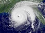
On September 1 this year, NO tropical storms were active anywhere on Earth.  This is the first time that has happened in 70 years. (September  is, on average, the most active month for tropical storms.)   Just in case you miss the usual Sept. portraits…hurricane


Pleasant Fall weather

Monday afternoon

Cool high pressure dominates the weather scene for now.  However, the high drifts eastward tomorrow far enough to allow southerly winds to begin a warming trend as highs return to the mid 80’s after a cool night tonight.  Hopes that late last week’s highs in the low 90’s would be our last of the year should be dashed by Wednesday as stronger southerly winds should push us to 90 or higher, but at least the humidity will be lower.  Both tomorrow and Wednesday should be generally sunny.

The next big change will begin Wednesday night as a cold front arrives.  Current thought is that the front should bring some showers and possible thunderstorms late Wed. night into Thursday morning.   The government’s “precip predictors” are forecasting this to be a significant rain-maker – 1″ or more for southern Indiana and most of KY.  My thoughts are that this system is very similar to last week’s Fri/Sat system that really fizzled out.  True, this time the cold front is stronger, but there’s just not enough moisture expected to squeeze out  a large area of 1″+ rain amounts.

The cold air mass is already pushing southward along the front range of the Rockies in Montana and will push wintry air as far south as Colorado as the week wears on.  Don’t be surprised if you hear about snows in Montana, Wyoming and possibly even as far south as Colorado this week.  As the cold air moves eastward it will thin and absorb heat from the warm soil.  So it won’t be nearly as cold when it arrives here.


Harvest Moon tonight

Last month we missed out on the chance to see the year’s biggest full moon due to clouds obscuring the view.  But this month we will get to see the most famous full moon – the Harvest Moon.  Look east right about 8 P.M. to see it rise in its full glory.  Our sky is pretty clean right now, so it will not look as colorful as the picture below, but it’ll still be great to see.

harvestmoon_strip

Photo:  Ruslan Merzlyakov  from Denmark.  Courtesy www.spaceweather.com


Cooler for the weekend

Friday afternoon

Weekend weather picture seems to be getting into better focus.  One thing is a sure bet- cooler temperatures.  Should be near 80 tomorrow and 78-80 on Sunday.  Much lower humidity slowly arrives tomorrow with its full effect felt by Sunday.  The question remains about rain.

I mentioned yesterday that any rain probably would not arrive until Saturday.  Now I’m starting to ask the question, “Will we get any rain at all?”  My answer is still “yes”, but it’s a pretty shaky yes.  Right now we’ve got a little of everything – warm, humid air mass, upper level energy approaching, and lower level convergence with a weak cool front.  Perfect set-up. But, the timing is all messed up!  First, the moisture is confined to the lower atmosphere – no help from the mid-levels (a negative).  Second, the strongest surge of upper air support should pass over the area around Midnight-3 A.M.  That’s several hours earlier than the cold front.  So, the energy arrives while the moisture is confined to low levels and the cold front is not around to support lifting air (another negative).  Third, when the cool front arrives (around 8 A.M.), the upper air support will be gone but the moisture will be higher in the mid-levels.  Without the upper support, the combination of a weak cool front and marginal moisture may squeeze out a few morning showers, but they will be light (probably .10″ or less).  Any appreciable rain should be gone by Noon or 1 P.M.

So, as you can see, there are a lot of things to consider for the next 24-hour forecast.  But, here’s what I’m thinking now…

Tonight:  partly cloudy and muggy…30% chance for a brief shower or thunderstorm after midnight.   Low… 74

Tomorrow:  Cloudy in the morning with a 30% chance for light showers, then mostly cloudy and cooler during the afternoon…high…80.  Clearing and cooler tomorrow night…low…60.

Sunday:  Mostly sunny and pleasant…high…78.

Forecasting note

Yesterday morning when I checked the forecast models, I was pretty convinced that today would be rain free around here, so I was pretty surprised the weather service went as high as 40% chance for this afternoon. During the afternoon, I did a quick check of some local media sites and they were generally leaning to the “low or no” rain chances scenario as well.  So, frankly, I was surprised when the weather service forecast continued with 40% storm chance for this afternoon.  This is one of the things I found really frustrating when I was working – when they latch onto a forecast, they seem to hold on far too long EVEN when everything they are looking at is telling a different story.    (Sorry about that, but I’m trying to work through years of frustration.)

Anyway. by their morning forecast today, they had dropped down to 20%.  Still too high as the rain train had left the station by that time,  but at least an acknowledgement they were catching on.

Another forecasting point about that forecast.  In general, since Tuesday, most forecasts had both yesterday and today with highs in the 90’s.  As it turns out, an accurate forecast.  But, yesterday with the weather service’s 40% chance for rain, the high predicted for today was dropped to the upper 80s.  That’s a good move – with a higher rain chance (which would cool the air) and most likely more clouds even if rain didn’t fall,  temperatures should be lower.  However, this morning when they pretty much dropped rain out of today’s forecast, they forecast a high in the upper 80’s.  Why?  (With rain and clouds gone, isn’t it reasonable that it should be a few degrees warmer?)

Showers enter the weather picture.

Thursday afternoon

Very quick today.  Still looks like tomorrow will be our last 90 deg. day for awhile – perhaps for the rest of the year.  A weak cool front enters the picture early Saturday.  Any showers and/or thunderstorms with the front should be Primarily in the Midnight to Noon time frame Saturday.  Models place the heaviest rains over southern KY Sat. P.M. and night.  The front leaves behind a beautiful day for Sunday.

Note: High school football games tomorrow night should have no rain/storm problems.  Primary chance for rain will arrive after the games end.

All quiet on the weather front

Wednesday afternoon

That pesky upper air ridge of high pressure is once again building strength over the Ohio Valley, so it appears we’ll be back into hot and humid weather again and Friday.  Once again, daily highs should be 90 or so with the heat index at 95-98 deg.

By Saturday, the ridge is expected to erode considerably as the upper westerlies strengthen and dig southward.  That could produce some rain as it brings in cooler, drier air.  If we are lucky, the next two days may be the last time we see 90-degrees this year.

Stuff

Remember Al Gore’s famous pronouncement that Sea Ice in the Arctic summer would disappear by 2013 or 2014 (depending how you interpreted his statement)?  Well, the melt season ends in a week or two – so what’s the status of the ice?

The ice is doing very well, thank you.  The chart below shows this years ice currently is about 5.2 million square kilometers. That’s still below the long-term average, but has building for the past two years.  And, this year’s ice is also thicker than recently – more evidence that the ice should continue to increase.  By the way, the Antarctic Ice Sheet reached record HIGH levels this year.Sea_Ice_Extent_v2


Some rain, then (a little) cooler

Labor Day afternoon

So far the day as gone well, mostly dry for the area although a few folks had a couple of light showers late this morning.  Still quite warm and humid and that could still pop up an isolated thunderstorm late this afternoon or evening.  (only about a 20% chance)  So it looks like a warm, but dry,evening for UL’s ACC opener at Papa John’s.

After midnight, the weather should start getting more active.  A weak cool front will move into areas west of us and spawn a large outbreak of showers/thunderstorms across southern Indiana.  Most, maybe all, of this system should stay north of the Ohio River overnight, but the weakening leftovers should push through the Louisville area during the morning tomorrow.  Skies will begin a slow clearing tomorrow afternoon and slightly cooler, less humid air will move in for Wednesday.

We should get a break from the 90’s tomorrow thanks to the clouds and showers.  Highs in the mid 80’s tomorrow and upper 80’s Wednesday (with lower humidity) will feel pretty good.  But, don’t get used to them yet, higher heat and humid should return by Thursday.

Stuff

For a product to be called “peanut butter” it must contain at least 90% peanuts.  On average, 540 peanuts are used to make a 12 ounce jar of peanut butter.