Category Archives: stuff

Thursday’s main concern looks to be sleet.

5 P.M. Tuesday, Feb. 1, 2022

Basic ideas put forth in yesterday’s post still hold.  However, some subtle changes in the models since yesterday, to my mind anyway, seem to be shifting the primary focus away from freezing rain toward sleet.  And we’re not talking about just a little sleet.  Over an inch of sleet is possible!  We don’t see that very often.

Here’s my current idea about this will play out.  Rain begins around rush hour tomorrow and continues off and on through the day and night.  Temperatures will be about 50 tomorrow morning and slowly fall into the lower 30’s by Thursday’s morning rush hour.

Thursday morning the rain will become freezing rain but, with daylight and temperatures in the lower 30’s, the freezing rain should create few problems.  Things get really interesting during the afternoon.  Sleet will mix in with the freezing rain and quickly become the dominate precipitation form until all precipitation fades away during the evening.  A brief period of snow will be possible as the sleet ends.

The big question in my mind is when the sleet begins.  An early afternoon start could result in significant accumulations while a late afternoon onset would create far fewer problems.  At this time, an earlier start looks more likely.  That would produce a 1″-2″ sleet accumulation – a major driving mess.

Things can still change in the next 48 hours.  Another update tomorrow.

Stuff

Over the past two years the Corona Virus has killed 0.3% of the U.S. population.  World War II  also killed 0.3% percent of our population, but it took twice as long.

Little, if any, snow tonight

4 P.M.  Wed., Jan. 19, 2022

Short term models continue to push tonight’s area of accumulating snow south.  Latest GFS isn’t out yet, but the trend is clear from the NAM, Nam HiRes, RUC and HRRR.  Louisville area should see possibly a dusting (less than a half inch) (two models) or nothing (two models).  So the pickings are pretty lean for snow lovers locally.

It’s a different story, however, for southern and eastern KY.  Wide area south and east of a line from southern Hardin County to  Frankfort to Ashland will see accumulations from 2″ to 4″.  Some spots will probably top 4″.

Louisville appears destined to see just a short period of snow.  Rain-to-snow changeover should happen between 6 and 7 P.M.  Any significant precipitation will end shortly thereafter.  That should add up to a dusting, at best.

Seasonably cold weather air takes over tonight and should last through Friday.

Stuff

Of every 15 potential cancer treatment drugs submitted to the FDA for approval, about 14 never make it out of the testing phase.

Model reversal

Thursday, Jan. 13, 2022  5:30 P.M.

Models still far apart

Yesterday, the GFS was predicting a big snow Sunday while the Blend of models was predicting little to no snow.  Today’s the Nam’s forecast reaches out to Sunday and offers another opinion.

Today, the GFS takes the storm considerably farther south before heading north along the Appalachians.  That means for us:  1″-2″ Sunday.

The BLEND continues on it’s southern track and a little east along the mountains.  For us: little, if any, snow.  If yes to snow, up to an inch.

The latest NAM has the storm track a little north and west of the GFS prediction.  Projection for us:  2″ – 4″ starting late Saturday.

Tomorrow: check back to see if the models get any closer to agreement.

Stuff

About 75 to 80 shark bites are reported around the world each year.  In New York City, however, roughly TEN times more bites are reported of people biting people.

Dry weather continues.

Rain chances are fading

Friday, August 13, 2021  4 P.M.

Looks like the “Friday the thirteenth” superstition will come true in at least one topic today…rainfall.  All week forecasters have been pointing to today as our best bet for some rain to ease our lengthening dry spell.  Now, however, it seems likely the rain won’t develop locally.

A weak cool front is slowly working southward over Indiana, but this front has been unable to generate any showers/thunderstorms today.  And most likely won’t be able to.  Instead, a line of showers and thunderstorms formed just east of us earlier this afternoon and is moving into northeastern KY.

Still some hope the front could kick up some rain this evening, but don’t count on it.  Short term models keep us dry tonight.  Needed rainfall won’t return until Monday afternoon at the earliest.

Stuff

Starting in the late 1890’s, Scottish-American industrialist donated funding to build 2509 libraries around the world.  1679 were in the U.S.  Indiana built 156 Carnegie Libraries while 23 were built in Kentucky.  Louisville got a $450,000 grant in 1899 to build 9 public libraries.

From 70 degrees to snow in 12 hours?

Tuesday, April 20, 2021  6 P.M.

It could happen tonight!

Our weather has been pretty dull lately.  Dull in the sense that not much “weather” has been nearby.  So most of April has been quite pleasant.  The absence of typical stormy Spring weather has allowed a great opportunity to see more of nature’s awakening beauty.

But, tonight’s weather could be highly unusual.  A small, but very cold, upper air system will drift over us tonight.  It’ll bring along a pocket of colder air behind a developing cold front.  That will provide enough lift to squeeze some moisture out of the atmosphere.  It won’t be much (less than a quarter inch) and won’t last long (from about 10 P.M. to 4 A.M.).  However, the upper level cold air will produce snow.  The big question will be “How soon will the surface cold air arrive.” At onset, the snow will be melted by the currently mild air so we’ll see rain.  The rain will help cool (by evaporation) the low-level temperatures.  That, along with the colder air advancing into our area, will create rapidly falling temperatures.  By about 2 A.M. temperatures should drop into the upper 30’s.  Then, the colder air will slow the melting process.  Basically, the smaller snow flakes will melt while the larger flakes should be able to make it to the surface before completely melting.  Over the next two hours temperatures may drop another degree or two, so at times it may become only very wet snow.  Then, by 4 A.M.  the steady rain/snow will move east of our area.

Snow accumulation?  Not likely on the ground or roadways.  However, some tree limbs, rooftops and cars/trucks could see small accumulations.

Then we’ll have a couple of unseasonably cool days before Spring returns.

Stuff

36 degrees is the 50%-50% temperature for rain and/or snow. Above 36 the odds rapidly favor rain.  Below 36, the odd rapidly favor snow.

Guns:  Since 1975, guns have been responsible for  the death of 1.5 million Americans. Since the Revolutionary War, about 1.4 million Americans have died in all U.S. wars and conflicts.  (Seems like our “well armed militia” is better at killing Americans than enemy combatants.)  Does anyone see a problem here?


Meteorologists’ nightmare

Tuesday, Feb. 16, 2021  5 P.M.

Nobody likes to be wrong.  Most of us can hide mistakes so that few people, if any, know you made one.  But that doesn’t hold for operational weather forecasters.  Our mistakes are out there for everyone to see (and ridicule) while most mistakes are hidden or denied.  Yet, as a rule, meteorologists are generally well liked.  My answer to this apparent contradiction:  a meteorologist is someone who everyone can feel superior to.

While yesterday’s blown forecast was truly a whopper,  I have no excuses.  Looking back, a few clues were available, but the heavy snow seemed a far better idea.  Unfortunately, I didn’t catch on until it was too late.  Often, in times like this, you’ll hear these comments:  1) We dodged the bullet., or 2). We got lucky this time.  TRANSLATION:  I missed the forecast, but I’m not going to admit it.

Let’s try again

Another storm coming out of the southwest has the potential to be a serious snow-maker.  This time, however, we’ll be on the northern side of the heaviest snow.  Models are in pretty good agreement with this one, but nothing much will be happening until late tomorrow.  So, that gives time for adjustments.

Here’s the way it looks now:  some light snow is possible (30% chance)  tomorrow but with little or no snow accumulation.  Snow likely tomorrow night accumulating 1″-3″ by Thursday morning.  Thursday morning flurries exit area by Noon.

Stuff

Sets of “identical twins” usually do not have identical DNA genomes.  About 90% of identical twins have genome differences ranging from a few to hundreds of sequence differences.  This comes from a newly published study in Iceland.

Snow gauge photo

Not much change since Sunday:


Looks like the NAM wins!

3 P.M. Mon., Feb.15, 2021

The news is not good…for snow lovers.

The latest NAM is joined by the short range NRRR model in pushing the heavy snow range northwestward away from the Ohio River.  The NAM was the only model to “see” this change earlier, but now it appears to be correct.

The sleet that has been falling for the past hour or so has brought, to me at least, the belief that the NAM has been right.  If the sleet had been snow we’d probably already have had an inch or two.  Instead we have a thin layer of ice pellets.

So, my forecast of just a few hours ago isn’t going to happen.  We will get snow, but also sleet until about Midnight.  But the sleet will keep accumulations significantly lower than expected.

New forecast:

Louisville metro: 2″-4″

Southern IN:  up to 20 miles north of metro:  3″-5″

South of Louisville metro:  1″-2″ (mostly ice).

Stuff

Over the years, the NAM has disappointed me many times with its seemingly inferior snow/ice predictions.  Today, I should have paid more attention.


The Ohio River conundrum

 Feb. 15, 2021  1 P.M.

On the edge

It is now clear that the axis of heaviest snowfall will lie north of the Ohio.  From western KY to Evansville to Indy and on to Lake Erie will be the heaviest snow – probably a foot or more by tomorrow.

South and west of that line snow totals will diminish slowly across southern IN, then the drop off quickens from the Ohio River south and east.

As a result of this shift, some small changes must be made to my forecast.  From 10 miles north of the Ohio River and northward,  I’m sticking with 8″-12″ by tomorrow morning.

For counties right along the Ohio River, expect 6″ to 10″ of snow.  The farther south and east you are from the river, the smaller the snow totals.  South of a Leitchfield to E-town to Lexington line, it’ll be mostly an ice storm.

Important note:  

The NAM forecast system is different from the other three models I’ve checked.  It places the snow prediction about 50 miles north and west of the other models (described above).  If that proves to be closer to the actual event, the Louisville area would only get about 1″-3″ of snow plus some sleet.

Stuff

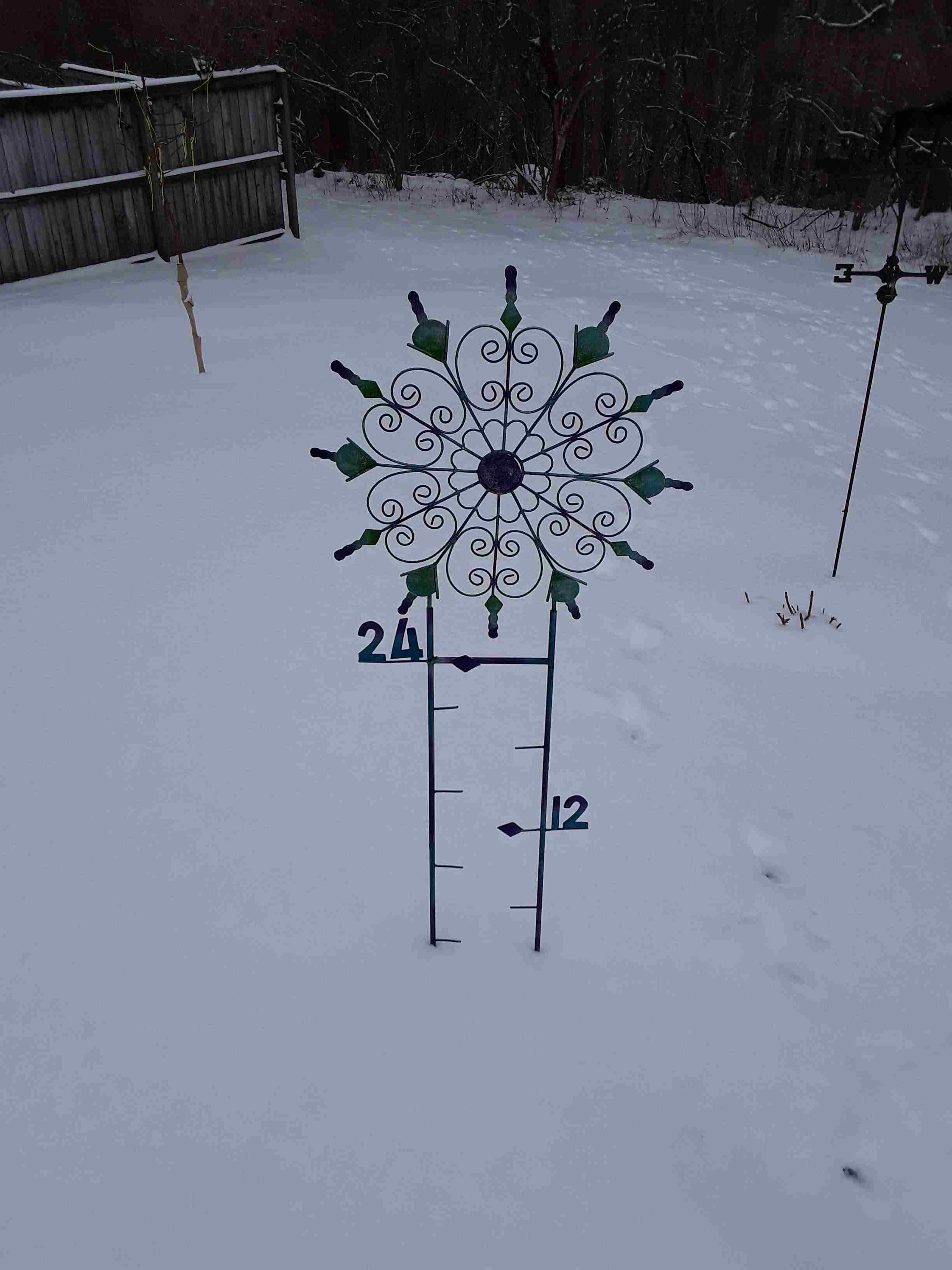
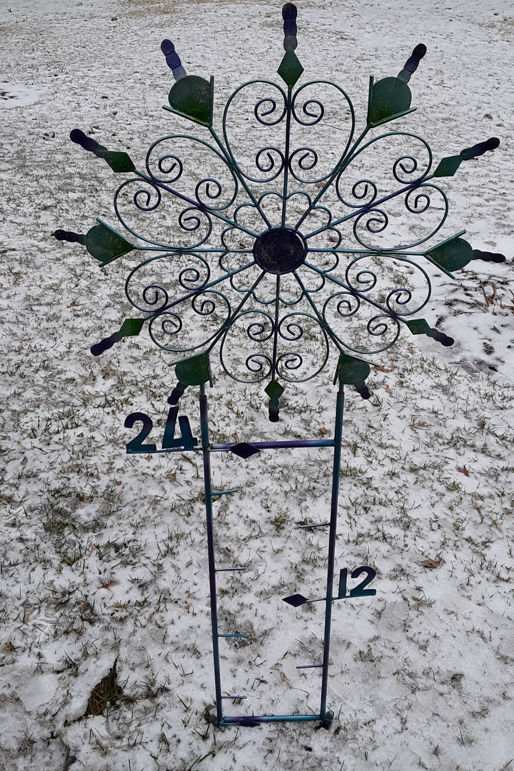
I have an unusual snow gauge.  It was given to me by one of my snow-loving daughters.

This picture is from yesterday.  I’m hoping it’ll look a whole lot different tomorrow!

Decision time

Sun., Feb.14, 2021  5 P.M.

Snow arrives after  midnight

Models continue to make a few tweaks, but even with several different opinions on surface patterns, they all seemed to have arrived at roughly the same general snow forecast for this storm coming out of the Gulf.  The upper air system seems to win out over the surface differences.  So, here goes…

An upper air disturbance ahead of the primary system will bring us snow starting after Midnight.  It should accumulate 2″-3″ by daybreak.  This system will fade out during the morning,

Then the primary system arrives during the afternoon with periods of moderate-to-heavy snowfall for about six hours.  Light snow should then fade away by Midnight.

Total Snow Accumulation:  8″-12″       Would not be surprised to see some areas get more than a foot of snow, especially north and west of Louisville.


Icy night ahead

Wed. Feb.10, 2021  6 P.M.

Biggest ice threat stays south of Louisville

Situation is playing out pretty much as discussed yesterday. Freezing rain will be the biggest concern for the Louisville area tonight, but sleet will mix in at times.  Primary precipitation will be over before Midnight, but a few periods of  light sleet and or snow will hang around until daybreak.  Any accumulations will be very small. In addition, ice accumulations (.1″-.2″) will fall short of the damaging range.

Southern Indiana will see an earlier end to the icy mix and, compared to Louisville, will have less freezing rain, sleet and snow.

Biggest concern remains the central third of KY.  (Far southern and SE Kentucky now appear to have a much reduced icing threat than mentioned yesterday.)  The central third – E-town, Leitchfield, Lebanon, Bardstown, Frankfort, Lexington, etc – will see freezing rain tonight continuing at least until Noon tomorrow.  Ice accumulations should run  .25″ to .50″.  That much ice can do a lot of damage to power lines and trees/shrubs.

Snow?

Earlier this week I mentioned how the GFS model seemed to be so much different from other models when it predicted more than a foot of snow on the ground here on Sunday.  Since then, the GFS has come into closer agreement with other models, but not total agreement.  The big Sunday “snowstorm” for the Ohio Valley  has disappeared from the GFS.  It never existed on other models.

Now the GFS is predicting a major winter storm to hit the Ohio Valley Monday night – significant snow possible!  Other models are also “seeing” this storm, but are moving it northward along the eastern side of the Appalachians.  That would only give us minor problems, if any.  The GFS pulls the storm up along the western side of the mountains.  That brings back memories of January 1978.  Could it happen again?

Stuff

Bob Gibson, the Hall of Fame pitcher for the St. Louis Cardinals who recently died,  played a season with basketball’s Harlem Globetrotters before moving to baseball full time.

6:15 update

Just saw the NWS forecast. WOW!!!