Friday, March 10, 2017 11:30 A.M.
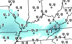
Oh, so close! But apparently not close enough as this morning’s GFS and NAM continue to keep any snow tomorrow afternoon just a bit to our west and south. Plenty of moisture seems to be available, but both models place the primary area of atmospheric lift about 200 miles to our west tomorrow morning, then curving around to our south by evening. We’ll be watching a very cloudy sky…most likely with nothing falling from those clouds.
But, we’ll see another chance for light snow/flurries late Monday into Tuesday.
Latest GFS snow forecast from last night’s run:

