Category Archives: forecast

Super Sunday

Sunday, 2/7/2016

Super Sunday turns out to have a double meaning for us…great weather plus the Super Bowl this evening.

First, the weather.  Enjoy today because winter will be rushing back in by tomorrow.  The commonly called “Polar Vortex”  is once again pushing south into eastern North America.  A sharp cold front will arrive tonight and replace the current seasonably warm  conditions with an Arctic blast.  Since the system’s origins precludes any significant amount of moisture, the cold air will only be accompanied by snow flurries and snow showers.  Timing makes a great difference in events like this. Day vs. night makes a big difference.  I discussed this in a Jan.14, 2016 blog…Observations from this week’s snows.  Check it out.

Here’s how the current situation is shaping up… cold air arrives late tonight along with a 30%  chance for rain showers.  It’ll take several hours, probably between 8-10 A.M., for the air to become cold enough to support snow rather than rain showers.  Periods of light snow likely during the afternoon with up to a half-inch on grassy areas.  Roads remain wet, but possibly a few slick spots on bridges and overpasses toward evening.

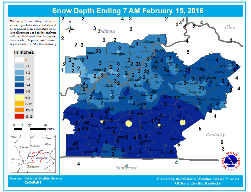
Monday night looks like the best  chance for accumulating snow from this system.  Cold air will be firmly entrenched, still some residual moisture will be around and an upper air pocket of energy looks as though it’ll fly overhead.  The result should be some light snow and some snow showers.  Most of us should see .5″ to 1.5″ by Tuesday morning. Some areas will probably see some heavier snow showers putting down as much as 2″-3″, but they should be pretty scattered.

By Tuesday, we’ll still have plenty of cold air (20’s for highs),  but there won’t be much moisture or upper support left.  So, snow flurries will continue, but little (or no) accumulation is expected.

Although this won’t be much of a snowstorm, there’s still the potential for some major road problems from early Tuesday through Tuesday morning.

Super Bowl

I’ve only attended one professional football regular season game in my life.  It was at Mile High Stadium back in the late 1960’s and featured Denver winning over the Buffalo Bills. I think the score was 17-14. I’ve had a warm spot for the Broncos in my hearts ever since.  But, trying to look objectively at today’s game, I think the Denver Super Bowl mystique will continue.  Denver has been in seven Super Bowls but has won only two.  The average winning margin of those games has been over 20 points.  All but one game have been blowouts, The Broncos have been on the losing end of a blowout five times.  Today looks like it’ll be #6.  (Sorry, Broncs and my sympathies go to Kent Taylor…a HUGE Broncos fan!)

Tornado Watch – south of Louisville

Update 2/2/2016

Some minor changes from previous 2/2/2016 blog.

A large, unorganized cluster of showers/thunderstorms has popped up over western KY and is spreading  NE.  Based on a few isolated storm reports, the Storm Prediction Center has issued a Tornado Watch for all of central KY south of the Louisville area. Models are even stronger than before on the rapid decrease in strength as this storm area moves east.  Heaviest storms, possibly severe, will remain over southcentral KY with a better chance in TN.  As mentioned, the storm cluster is moving into an unfavorable stability situation, so heavy remain seems to be the main concern in the Louisville area (35 miles in all directions from city).

Primary threat remains the cold front itself. It is suddenly getting very active near the Mississippi River.  This still looks as though it’ll pass through the Louisville area between 10 P.M. and 2 A.M.  It, too, will have the instability problem but should produce some very heavy rain. (See earlier post)

Windy…yes. Stormy…maybe.

Tuesday, 2/2/2016

First, the Wind Advisory…

...WIND ADVISORY IN EFFECT FROM 1 PM THIS AFTERNOON TO 7 AM EST
WEDNESDAY...

.THIS AFTERNOON...CLOUDY WITH SCATTERED SHOWERS AND
THUNDERSTORMS. HIGHS AROUND 70. SOUTHEAST WINDS 10 TO 20 MPH.
GUSTS TO AROUND 40 MPH IN THE AFTERNOON. CHANCE OF PRECIPITATION
40 PERCENT.
.TONIGHT...BREEZY. SHOWERS AND THUNDERSTORMS. SOME THUNDERSTORMS
MAY PRODUCE DAMAGING WINDS. LOWS AROUND 50. SOUTH WINDS 10 TO
25 MPH WITH GUSTS TO AROUND 40 MPH. CHANCE OF PRECIPITATION NEAR
100 PERCENT.

Now, here is the NWS definition for a Wind Advisory…

Wind Advisory

A Wind Advisory is issued when the following conditions are expected for 3 hours or longer.

1) sustained winds of 31 to 39 mph    

AND/OR

2) wind gusts of 46 to 57 mph.

Notice anything unusual?  Yes, the forecast doesn’t came anywhere close to the definition.  And, this is the third time they’ve done this in the past couple of months!

So, let’s put it this way…it’s going to be noticeably windy this afternoon and tonight.  But, Wind Advisory criteria?  Very doubtful.

Severe weather situation

As a massive winter storm moves slowly NE out of Kansas toward the western Great Lakes, a major outbreak of severe storms is expected along the Mississippi Valley late this afternoon into early evening.  The western third of KY and southwestern IN could be hard-hit.  But for the Louisville area the situation is much different.

As is often the case with winter severe storm outbreaks, the dynamics (wind fields, etc) are very strong.  But the thermodynamics (temperatures, moisture, etc) are weak.  Sometimes, the dynamics can overwhelm the weaker thermo and wreak havoc.  That is expected late this afternoon and early evening along and near the Mississippi River.  Severe storms and some strong, long track tornadoes appear possible.

During that time, the thermodynamics will be at their peak.  But, the models never bring any positive thermos into central KY or southern IN.  Any instability dies quickly to our west after 6 P.M.  As the cold front slowly advances eastward, the expected severe storm areas consolidate into the line of gusty winds and very heavy rainfall as it approaches the I-65 corridor.  Biggest threat for our area should be flash flooding.  It’s possible we could see 2″-3″ of rain in a few hours, so watch out for flooding in low-lying areas.  If flooding is going to occur, it should be Midnight or later

As for the timing of the windy, rainy and possibly stormy weather…  For the Louisville area, the primary squally system should pass the area between 10 P.M. and 2 A.M.

Note:

The definition of the severe thunderstorm is Winds reaching 58 mph or higher and/or one inch hail.  I don’t believe either of those items will occur in the Louisville area tonight.  NEVERTHELESS, I do believe a Severe Thunderstorm Warning will be issued locally.  After all, can anybody remember the last time a moderate to strong line the thunderstorms has passed Louisville WITHOUT a warning being issued?  (It’s kind of like that Windy Advisory thing.)

Stuff:

I was happily impressed with the Cardinals win over UNC last night.  Good testament to the character of the team to bounce back from Saturday’s game with UVA.  It also speaks well for a team, such as UVA, that can completely change a game with their exceptional defense.

January thaw has late arrival.

Thursday 1/28/2016

Weather update:

After a couple weeks of wintry weather, a common January weather feature is entering the game – the January Thaw.  For centuries, weather watchers have noticed a tendency for a period of milder, calmer weather to hit the eastern half of the U.S. during the latter part of January.  This year (it doesn’t happen happen every year) it’s a bit late. We’ve been experiencing a rather weak example of it this week, but it’ll really kick into action by the weekend.  Temperatures could reach 60 or so then, but it’ll be even warmer early next week when even 70 degrees is not out of question. A strong storm will come out of the southwest early next week and move northward through the Mississippi Valley.  That will bring us strong southern winds and warm, rainy weather Tuesday and Tuesday night.  That’ll be it for this year’s “Thaw” as wintry conditions will return by midweek.

The “10 year deadline” has passed.  Why are we still here?

It was 10 years ago this week when former Vice President Al Gore made his (at the time) famous proclamation that if we didn’t make drastic efforts to end global warming in the next 10 years, Earth was doomed.  Well, the years have passed, Earth hasn’t warmed (according to satellite data), we haven’t done much to reduce the supposed enemy – carbon dioxide, and everything seems to be rolling along smoothly.  Of course, Al’s made a fortune acting as the shill for some climate fanatics, so he’ll be well prepared when the end arrives.

If you’d like more detail on Al’s proclamations and predictions, check out this article from the climate website Watt’s Up With That?   http://wattsupwiththat.com/2016/01/25/state-of-the-climate-10-years-after-al-gore-declared-a-planetary-emergency-top-10-reasons-gore-was-wrong/

2015 – Hottest Year Ever?

Last week our government announced NOAA ‘s and NASA’s findings that 2015 was the warmest year on record.  This is based on their analysis of global surface data that they have “adjusted” so many times as to be barely recognizable.  But, it fits the agenda.  Interestingly, our government also pays two groups to measure Earth’s temperatures.  Have you ever heard satellite data discussed during their “hottest this, warmest that” press conferences?  No, I didn’t think so.  The two satellite groups are GSS (Global Satellite Services) and UAH (University of Alabama-Huntsville).  The satellite global temperature surveys began in late 1978 and have closely matched each other over the years.  Why haven’t you heard about them?  This graph shows you why… Screenshot 2016-01-28 at 1.11.58 PM    Satellite data doesn’t support the agenda.

Odds and Ends

Monday, 1/24/16

Such arrogance

I saw in Saturday’s paper that the National Weather Service, in commenting on Friday’s (lack of) snow, said that the storm had “underachieved.”  I was dumbfounded!  They didn’t blame the lack of snow on a bad forecast (it was) or on the “models” (they did a pretty good job).  Rather, they blamed the lack of snow on…nature itself!  Nature doesn’t make mistakes, it always does what the physical laws dictate.  So, what happened was EXACTLY what nature intended.  The storm neither “underachieved nor “overachieved.”  It achieved exactly what it was supposed to.   When you look at the snow left behind over the eastern U.S., it is hard to say the storm “underachieved.”

Unfortunately, such arrogance runs rampant through many of our government science-oriented agencies.  From NOAA, NASA, EPA and all the way up to our scientifically gullible President the thought exists that we (mankind) have to stop nature RIGHT NOW!  If we don’t, the planet is going to kill us all.  Nonsense!!!  Who’s to say what the Earth’s average temperature should be?  Our climate always changes, has been for millions of years.  Warm spells, ice ages…it hasn’t mattered.  Life goes one, but it, too, changes.  Estimates suggest that about 97-98% of all the species that have developed on Earth are now extinct.  (Anybody ever hear of a man named Darwin?)  In more recent times, we believe Earth was warmer than now around Biblical times and again for 300-400 years centered around 1050.  Then we had the “little Ice Age” which ended in the mid 1800’s.  Since then, we’ve had an irregular, slow warming.  Over the past 100,000’s of years, what have humans done to survive?  They have adapted to the changing climate.  Or, perhaps a better word to use is (one of my favorites) ACCLIMATIZED.  They have adjusted to the changes in climate.  Now, all of a sudden, that won’t work!  We, as the human race, must stop nature in its tracks!  Our governmental gods say it can be done and have told us how.  They seem to think that we won’t notice if our economy is destroyed and our life style is set back about 100 years, or so.  Such arrogance!

We’ve already wasted trillions of dollars for projects that have given very limited results.  Solar and wind can generate power, but at a cost two to ten times higher than traditional power. (Your tax dollars are paying for that illogical economics.)  Plus, wind and solar need backup “traditional” power supplies because that have “down” times – night and calm winds.  A far, far better use of all that money would have been to rebuild/improve our nation’s infrastructure.  But, no, say our leaders, we can stop nature.  Good luck with that.

But, a happier note (maybe)

Although we humans have greatly altered and changed nature in our time on Earth, nature doesn’t really care.  It just follows the new rules and keeps on going.  The current El Nino has warmed Earth this past 6 months and will ease only slowly over the next 6-9 months.  Meteorologists who study Earth’s climate have studied and observed how climate has shorter term cycles in the weather/climate cycle that the current scare- mongering climatologists ignore.  They say the items are insignificant and are not included in any of the climate models predicting doom and gloom.

Many meteorologists (myself included) believe that plots of two of the items show a much higher correlation to reality than any climate computer model currently used.  Based on these items (ocean currents- major and sunspots- minor), we believe that Earth’s temperatures are due for a return to cooler temperatures after the current El Nino ends (late spring).  The ocean currents and low sunspot numbers, we believe, will provide a cooler Earth for the next 10 to 20 years

Just can’t let this go by…

From yesterday’s CJ…Charles Barkley on Chicago Bulls’ Jimmy Butler…

“Other than LeBron James, he’s been the second-best player in the Eastern Conference all year.”

(As a person who made a living ad-libing, I know how easily this can happen.)


OMG OMG OMG

6 P.M. Fri 1/22/2016

I am flabergasted at the new NWS forecast…just cannot believe it.

A few more tenths of an inch possible before this wraps up by 7-9 P.M.  But, we’ll see plenty of blowing and drifting snow tonight.

3 P.M. update

Friday, 1/22/2016

Snow intensity is winding down. but periods of light snow should continue until around 7-8 P.M. Radar shows the northern edge of the light snow is slowly drifting from southern IN toward Louisville.  It’s going to be tough to measure from here on out because of the strong winds and blowing snow, but any additional accumulations will be less than one inch for the Louisville area.

Snow totals appear to be highly variable, but nothing extreme.  At SDF the snow depth was measured at 7 A.M. and showed 3″ and at 1P.M. the snow depth was also 3″.  My driveway had 2.4″ around 1 P.M. and little snow since then.

It’s hard to imagine the NWS is still maintaining the Winter Storm Warning and the 4″-6″ snow forecast for Louisville.

But then, as Yogi Berra famously  said, “It ain’t over ’till it’s over.”

Snow is here – how much?

Friday a.m. 1/22/2016

Updates and adjustments

This morning’s computer runs have continued the southern route, even more than I thought.  Nevertheless, snow has been coming down prettily for the past couple of hours.  The other, more significant, change is the increased forward speed of the storm.  According to the models, the primary energy is already pushing into the Appalachians.  Heaviest bands of snow, etc. have already pushed east of I-75.  That means the 8″-12″ snows expected south of Louisville toward Bowling Green will probably not materialize.  But, 12″+ plus still looks like a good bet over southeastern KY.

With the primary energy pushing eastward so quickly, that will shorten the time we’ll be under a moderate snow cover.  Last night, the target time for the heaviest snow was expected to be between Noon and 6 P.M.  Now, the models are pointing toward the best chance for heaviest snow to  be ending by 1 or 2 P.M.  After that we’ll see mostly light to occasionally very light snow through early evening. Snow should be ending by 7-8 P.M.

Radar trends are already showing diminishing trends to the snow locally.  That should hold through the afternoon.  Even though this is a huge storm system, with the primary energy production moving east, we’red stuck with the leftovers.  Still plenty of moisture left, but for us the dynamics to produce heavy snow are weakening.

But, I have revised my forecast for snow upward a bit.  Louisville area should see an accumulation of 2″-4″

More in a few hours.

Has Goldilocks left the forecast?

Thursday afternoon, Jan. 21,2016

(update to get my fairy tale character correct.  Who knows, maybe this whole blog is a fairy tail.  TW)

In my years following major winter storms, I’ve noticed they bunch into two major storm tracks.  One I’ll call the northern track the other will be the southern track.  The most common for us is the northern track storm which forms east of the Rockies, slides into Texas then curves northeast.  Quite often these come right up the Ohio Valley.  That sends the heaviest snows over central and northern Indiana while we’re left with some snow changing to rain.  The southern storms form over southeastern Texas then move ENE across the Gulf States.  The northern edge of these sometimes spreads precipitation as far north as the Ohio River.  Often the snow only reaches into southern KY.  The long-term climatology of the area shows these two storm tracks account for a huge majority of our winter storms.

Once in awhile, we get a “Goldilocks Storm”.  One which takes a track roughly halfway between the two favored tracks. These have been big snowmakers.  Remember last March?  Goldilocks Storms require everything (for us) to be “just right.”  Early this week, it looked as though Cinderella was going to pay us a visit.

Things changed yesterday (check yesterday’s blog for more details) when the models started shifting toward a more common southern track.  Today’s runs have solidified into a traditional southern storm – the GFS and NAM are in remarkable agreement.  This is a very large storm, so there is still a good chance that snow will move into northern KY/southern IN.

What to expect.

1). The southern half of KY can still expect some major icing late tonight changing to snow tomorrow morning.  Heaviest snow accumulations(6″-12″)  will occur over southcentral KY then SE KY, southern WV and VA.

2).  Louisville area.   Snow should not arrive here until late morning.  If we’re going to see any heavy snow it’ll be between Noon and 6 P.M.  Snow will taper to flurries during the evening.  Along the Ohio River and 20 miles south of the river snow accumulations should run 1″-3″ .  Accumulations increase rapidly south and southeast of Louisville (E’town, Bardstown, Lex should be 4″-6″.)  Accumulations over southern Indiana will be small and not get too very north of the river.

So, that’s the way I see it shaping up now.  It’s subject to change, of course.  Tonight’s runs may change things again.  And, don’t look for any hope from the European and Canadian models.  They are farther south.  We’ll be lucky to get one inch if they are correct!

So, has Goldilocks left the neighborhood?  Not yet, but she has her coat and scarf on…and is heading toward the door.


How much snow?

Thursday morning, 1/21/2016

Quick update after a glance at morning GFS and NAM model runs.  The trends remain the same as yesterday afternoon’s update mentioned – the primary storm track still looks to be on a track too far south to bring the really heavy snows as far north as the Ohio River.  Things are running a little slower as snow may hold off until around late morning or Noon tomorrow. (Makes the Winter Storm WARNING going into effect at 7 P.M. tonight look rather silly, doesn’t it? )

Still looks about the same – 3″- 5″ or 6″) in Louisville area.  Rapidly increasing totals up to 6″-12 south of the metro (across central KY).  Rapid drop in accumulations north of the Ohio.

More later.