Category Archives: commentary

Rainy weekend – mostly at night

5 P.M.  Friday, Feb. 26, 2021

Two upper air disturbances will float over the Ohio Valley this weekend.  The weaker one we’re seeing now.  Mostly light showers will be scattered over the area this evening…ending after Midnight.  Tomorrow will be warmer with mostly cloudy skies pushing temperatures into the mid 60’s.  The second system will have more moisture and energy, heavier rains will be likely tomorrow night into Sunday morning.  Our area should expect over an inch of rain with warm temperatures tomorrow night.  Temperatures remain warm Sunday.

This time no major storm development is expected, so no major surge will move in as the rain stops, so temperatures should remain seasonably mild early next week.  The average high temperature in early March is in the lower 50’s.

I have seen the future…and it is here.  part 2

The recent ice storm disaster in Texas has been used as quite a political tool for various ideologies.  The right blames solar and wind power problems (partly correct).  The left blames fossil fuel problems (partly correct).  Many say the state-run power network was the cause (big contributor).  Still others blame climate change (probably not – ice storms in Texas have a long history).  Actually, many factors combined to make a situation far worse than it should have been.

Most at fault is the government of Texas.  To allow the statewide power grid to reach the ridiculous situation that exists there today is a wonderful example of political corruption based on money rather than the public good.  It’s a rag-rag operation of little operators with little coordination.  It’s like one of those dominoes creations where you tip over one domino and hundreds  (or thousands)  more also tip over.

In recent years, a push toward solar and wind power generation has been established.  Today that produces roughly 10-11% of Texas’s total power input.  Wind and solar are unreliable because sometimes the wind doesn’t blow and the sun doesn’t shine.  But losing just 10% of your power supply shouldn’t do much damage to the overall grid.  Most of the power comes from good old fashioned power plants using either coal, oil or natural gas.  Texas also produces some nuclear power.  In recent years, for environmental concerns, coal and oil plants have been phased out along with nuclear power.  The use of natural gas, the cleanest fossil fuel, has been growing rapidly.  Okay, most states are doing the same thing, so what went wrong?

In the push to increase natural gas usage and build wind and solar facilities, something has been either forgotten or neglected, or both.  Infrastructure!  No repairs. No updates.  No improvements to existing equipment.  The existing infrastructure has been falling apart.  In a crisis they can’t ask neighboring states to sell them some extra power (state law).  So, when a crisis hits -usually winter storms and summer heat waves – they are stuck.

The way things are going, the power situation in Texas will get far worse before it gets better.  The best thing they can do to clean up their power mess is to build nuclear power plants.

Texas is not alone in this rush to “clean energy.”  Many other states are losing their energy independence.  More on that on part 3.

Early Spring weather

Tuesday, Feb. 23, 2021  4 P.M.

Weather patterns certainly have changed since last week.  Rather than ice, snow and 20’s we’ve jumped to mostly sunny and 50’s.  This trend is expected to persist for quite a while.  The circumpolar jet stream vortex that dipped south over Canada and central U.S. has retreated toward the pole and reformed westward.  The result has been a return to the “west coast trough, east coast ridge” pattern that has dominated most of our winter.

For the next few weeks (or longer), major storms will move into the western U.S. then move northeast into the central and eastern U.S.  That major storm track will bring plenty of rain to the central part of the country, including the Ohio Valley.  It also threatens to give an early (and widespread) start to the severe weather season.

I have seen the future…and it is here! (Part 1)

My apologies to whoever first uttered those words, but it seemed to fit.

The Texas ice storm has been quite a catastrophe.  The media seems so surprised by the ice storm – acting like it’s never happened before.  In fact, if anyone chose to check, a major ice storm hits Texas about once every eight years.  Ice storms are a known, expected, but rare, event.  The most recent serious ice storm was in 2011.  In fact, since 1973, six major ice storms have hit Texas.  After each one, committees were formed to make suggestions about how to better prepare for the next one.  After the first five storms, the recommendations were largely ignored.  Why? Cost.   (We’ll continue to hold together our deteriorating infrastructure with baling wire and duct tape and hope that it doesn’t happen again.)  But it always does.  I don’t imagine it’ll be any different this time.

We’ve heard many “reasons” for why the problems occurred.  Every “cause” has a different reason for the disaster.  Next time, we’ll take a look at the “blame game.”

Stuff

Recently in Washington state,  police arrested a man for carjacking. He had been released from prison just 20 minutes earlier.

Caution:  If you’re bad at haggling, you’ll end up paying the price.

Picture

Smoke billows from Mt. Etna near Giarre, Sicily. | (AP Photo/Salvatore Allegra)
From The Week

That’s it for winter, at least for awhile

Friday, Feb. 19, 2021  4 P.M.

Warming

I have found it interesting over the years how February almost always has a period of a week to 10 days of very wintry weather.  Otherwise, it’s just the usual grey skies and gloomy scenery.  Well, we just experienced our “mini-winter” and now a warm up will have us thinking of an early spring for the rest of the month.

Tomorrow will have a cold start – about 13-15 degrees – then warm to the mid 30’s.  Then about 10 degrees warmer Sunday.  Then a few days in the 50’s (possibly 60’s) next week.

Meanwhile, Tuesday’s storm dropped a sleet/snow accumulation of 4″ at the airport.  Then Wednesday night’s snowfall of 2.9″ pushed the accumulation up to 5″ at SDF.  NOTE:  Snowfall and snow accumulation are not the same. Tuesday night’s snowfall was listed as 5.5″ but the sleet/freezing rain knocked the accumulation down to 4″.  Due to some melting and settling,  the later snowfall “refreshed” the old snow/ice and boosted accumulation back up to 5″.

Snow gauge update

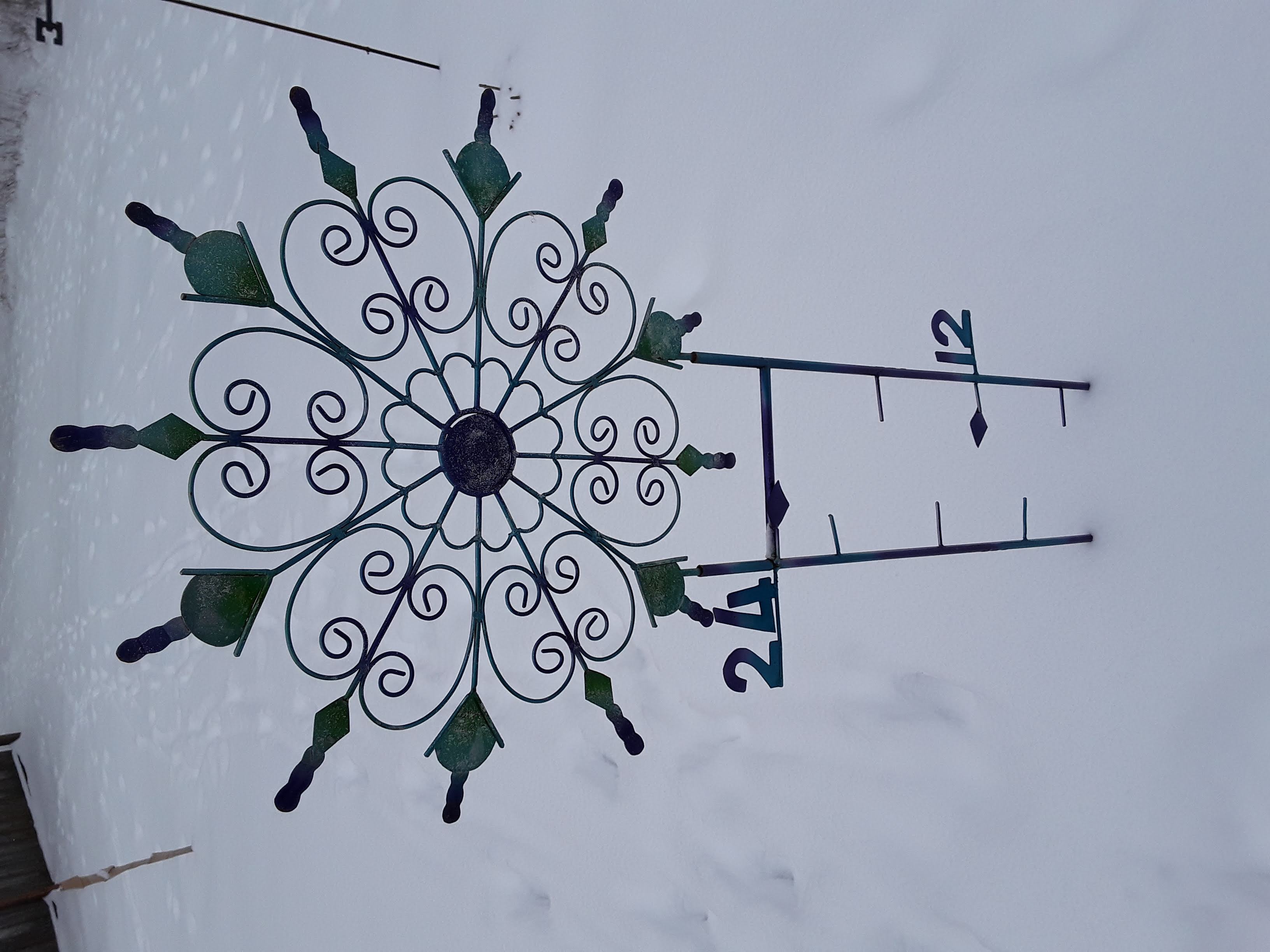
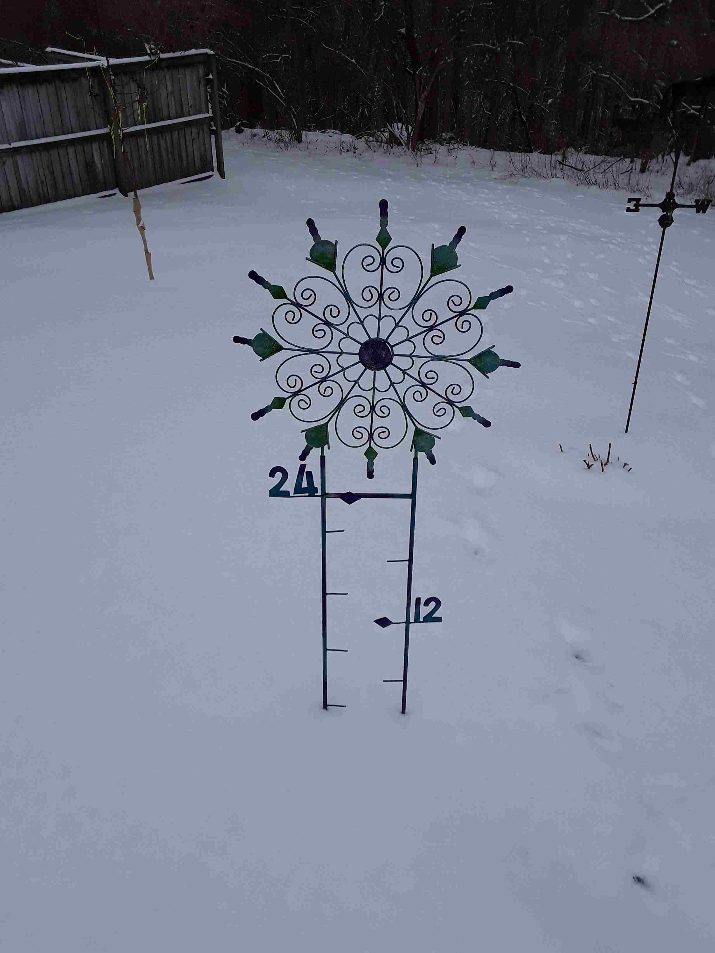
I’ve been showing pictures off my very optimistic snow gauge this week. You can go back to see them, if you wish.  The first showed just a trace of snow/ice before the expected snowstorm Monday night.  The second photo was from Tuesday morning.  It showed just under 3″.  You can see the 3″ marker line on the left side of the gauge.  Today’s photo is from yesterday morning.  About 5″ inches on the ground.


Meteorologists’ nightmare

Tuesday, Feb. 16, 2021  5 P.M.

Nobody likes to be wrong.  Most of us can hide mistakes so that few people, if any, know you made one.  But that doesn’t hold for operational weather forecasters.  Our mistakes are out there for everyone to see (and ridicule) while most mistakes are hidden or denied.  Yet, as a rule, meteorologists are generally well liked.  My answer to this apparent contradiction:  a meteorologist is someone who everyone can feel superior to.

While yesterday’s blown forecast was truly a whopper,  I have no excuses.  Looking back, a few clues were available, but the heavy snow seemed a far better idea.  Unfortunately, I didn’t catch on until it was too late.  Often, in times like this, you’ll hear these comments:  1) We dodged the bullet., or 2). We got lucky this time.  TRANSLATION:  I missed the forecast, but I’m not going to admit it.

Let’s try again

Another storm coming out of the southwest has the potential to be a serious snow-maker.  This time, however, we’ll be on the northern side of the heaviest snow.  Models are in pretty good agreement with this one, but nothing much will be happening until late tomorrow.  So, that gives time for adjustments.

Here’s the way it looks now:  some light snow is possible (30% chance)  tomorrow but with little or no snow accumulation.  Snow likely tomorrow night accumulating 1″-3″ by Thursday morning.  Thursday morning flurries exit area by Noon.

Stuff

Sets of “identical twins” usually do not have identical DNA genomes.  About 90% of identical twins have genome differences ranging from a few to hundreds of sequence differences.  This comes from a newly published study in Iceland.

Snow gauge photo

Not much change since Sunday:


Deja Vu

Monday, January 11, 2021  6 P.M.

It’s happened again!

Yesterday’s post was about a little “pet peeve” about the National Weather Service’s failure to update forecasts when they go bad.  For details, read yesterday’s comments.  Well, it really surprised me to see the same situation again today.  Only this time, the forecast also hit upon another one of may pet peeves.

Today’s forecast called for mostly cloudy skies this morning with skies becoming partly cloudy during the afternoon.  A late morning look at the situation showed that clearing, if any, would be very slow this afternoon.  So a forecast update then should have been a downgrade to at least “mostly cloudy” or , even better, “cloudy.” But, since midday updates aren’t required anymore, nothing happened.

My second pet peeve of the day is this…many times the morning forecast contains messaging for “this morning” and “this afternoon” rather than “today.”  That’s good.  After all, weather does change.  To me, it seems like a sensible idea that around Noon the forecast should be reissued removing the “this morning” wording.  Makes sense to me.  But, I can’t tell you how many times I’ve gone to the NWS forecast during the afternoon and the first phrase of the forecast contains the words “this morning.”  It’s just common sense.

Stuff

One of my favorite quotes…Common sense isn’t.

The “good old days”

Sunday, January 10, 2021  12:30 P.M.

One of things I miss from the old days is the updated forecasts issued by the NWS around 11:30 A.M. and P.M.  Forecasts were not as accurate in those days, so the updates to the “prime” morning and evening forecasts were sometimes needed.

Somewhere along the line it was decided that the morning and evening forecasts were all that was needed.  Updates became hard to find.  Today’s forecast is a perfect example why that may not be such a good thing.

When I got up this morning, my radio told me “sunny skies today with a high near 40.”   But it wasn’t sunny, so I went to the NWS site to see what they were saying.  There I found a forecast for Jefferson County of “partly cloudy with a high in the upper 30’s.”  Ok, that was still in play.  Later, however, taking a little closer look at the actual weather data and satellite imagery, I noticed that the models predicted the sunnier part of the day to be during the morning with clouds increasing again during the afternoon.  A quick look at satellite views shows increasing clouds advancing eastward from western KY.

So, now the morning forecast no longer seems to be “in play.”  In the old days, the 11:30 A.M. update would (should?)  have put the forecast back on track.  But, at last glance, the incorrect forecast still stands.  Surely someone at the NWS would want to correct it (and drop the “high” to the mid 30’s).

Stuff

The music for the song, Twinkle, Twinkle Little Star, is the same tune that is used in the ABC song we use to teach children the A, B, C’s.

The composer of that music was Mozart!

Huh?

Wednesday, June 10, 2020

Latest NWS forecast reads like this:

Detailed forecast for

Jefferson County

Late This Afternoon
Breezy. Partly cloudy. Slight chance of showers and thunderstorms early in the evening. Some thunderstorms may be severe with damaging winds and large hail early in the afternoon. Southwest winds 15 to 25 mph. Chance of precipitation 20 percent.
It is confusing, at the least.
Missed opportunit
Although we did see some showers yesterday, rain totals were small.  Today’s missed opportunity was our last chance for awhile, and that’s bad news.
 A strong upper air ridge will be building over the mid U.S. and will provide a long stretch of dry weather.  Temperatures are expected  to remain near-to-below normal, so it won’t be heat wave conditions,  but the ground will be drained of moisture quickly.  Early in the growing season is a bad time to have a dry spell because dry areas tend to feed on lack of moisture and grow.  Normally, summers tend to get drier as we get into July and August.  That usually bodes poorly for the growing season.  If these trends continue, we could be in for a hot, dry late summer.
Stuff
1).  Coronavirus  cases in the U.S. are growing again as we reopen.  However, deaths from the virus are continuing to fall – about 1000 per day lately.  Seems like the older generation (people like me) is sticking by the masks and quarantining while the younger ones are less severely ill from the virus.
2). Cudos to our Prevaricator In Chief.    Must give credit where its due.  When he ran for President, Mr. Trump  (PIC) ran on two big issues.  1).  Build a wall.  2).  Make America Great Again.  Well, he has succeeded at both.  First, he imagined a great wall to keep the “good guys” (us) in while keeping the bad guys (Latin Americans) out.  He got his wall, but it didn’t quite work out as he imagined.  Instead, the much smaller wall around the White House is designed to keep the good guys (concerned Americans) out while keeping the bad guy in – hiding in his bunker.  Yes, PIC the world is laughing – not at us, but at you.
Then there’s MAGA.  Frankly, I never quite understood this slogan.  At least for the past 200 years when compared to the rest of the world, America has always been great.  We’ve had our problems, but we’ve been slowly improving over time.  But, when faced with a crisis, our PIC has really come through.  Yes, we’re NUMBER 1 – in a big way!  By huge margins,  we lead the world in coronavirus cases and fatalities!  Yes, we are NUMBER 1.

Computer models, part 3

Tuesday, May 5, 2020  6 P.M.

Current weather:  A strong upper air disturbance over upper midwest now will rotate southeast toward Kentucky tonight.  This system will provide some reasonably potent lifting motions over the lower Ohio Valley late tonight.  Not much moisture is available, but additional periods of light rain/drizzle are likely late tonight into tomorrow’s morning rush hour.

We’ll get to see some sunshine as tomorrow wears on, but temperatures will remain unseasonably cool.  The below normal temperatures will likely continue through the next week or two.

Computer models, part 3

The past two posts have told the story how weather forecasting and computers have been wedded since the beginning of electronic computing.  Today there are computer models/projections for just about everything.  Even one that predicted Secretariat to win the Super Derby last Saturday.

We all know that weather forecasts certainly are still not perfect, even though meteorologists have been at it the longest.  Other forecast models have the same problem, but do get better with age.  That leads us to the Coronavirus Models,  Unlike sports, weather, economics, etc., the available data on pandemics is pretty sparse.  Luckily not many pandemics occur.  Nevertheless, models have been built and put into action.  As expected we are hearing a variety of conflicting reports.  Pandemic modelling is a relative new field…its going to take some time for the model errors to shrink.  But with more data rapidly becoming available, improvement will occur.

Early talk of millions of deaths possible in the U.S. were simply “potential”.  They assumed no precautionary steps taken.  When precautions/restrictions went into effect across the country, the oft-quoted University of Washington model predicted 100,000 to 240,000 fatalities.  Our PIC (prevaricator in chief) just laughed that off.  Meanwhile, as the volume of data escalated, a few weeks later, UW lowered its prediction to 60,000.  Subsequent revisions went to 68,000 and then to 76,000.  All the recent revisions have been ridiculously low.  I’ve been watching the case/death numbers closely.  They just didn’t mesh with the predictions.  For example, Monday UW estimate was still in upper 70,000’s.  Just following the daily data, it was obvious we’d exceed that this week.  But, then, yesterday…

Kudos to the New York Times

For some (obvious) reason, it appears that PIC and his gang have been withholding information from an internal government forecast model.  That model predicts total U.S. deaths at 135,000.  To me, that number seems about right.  But with the recent rush to reopen the country, even that number could be low.  Thanks to the Times for breaking this story.  PIC, however, will likely just discard it as “fake news.”    (The only thing worse for PIC was if Jeff Bezos’ Washington Post had broken the story.)

A little rain tonight

Sunday, March 22, 2020  6 P.M.

A weak upper air system will pass over the area tonight.  However, it’s not likely to bring much rain.  Low level moisture is very low, so it’s going to take a long time for the rain/snow above us to saturate the air to bring us some rain.  A few sprinkles or patches of light rain are possible this evening.  However, our best chance for some light rain will be for rush hour tomorrow morning.  Overall, total rainfall from this system will most likely be a trace to a couple hundredths of an inch.

If you’ve been watching radar this afternoon, you’ve been seeing in action what I described above.  If you have watched Louisville radar, you’ve seen rain all around us, but none close to us.  However, if you’ve seen so-called “composite” radar, it looks like we’ve had rain for the past few hours.  In fact, it has been raining aloft, but not reaching the ground.  It’s evaporating before it hits the ground.  You may see gray vertical streaks coming from the clouds.  That’s called virga – falling precipitation evaporating before it reaches the surface

Note:  Composite radar, which most media outlets show, integrates data from all NWS radars in the area.  Locally, what we are seeing is a merging of radar data from our radar (at Ft. Knox) with data from Nashville, Cincinnati, Indy and Evansville.  While our radar sees no rain, the others all show rain aloft over Louisville.  Compositing also creates problems for accurately locating thunderstorms.

Stuff

Being of a certain age, I’ve been closely following the spread of the coronavirus.  I’m also a scientist and have been closely watching the numbers.  As a result, I’m convinced we’ve reached the point of no return. Within the next day or two,  I expect the U.S. healthcare system to become completely overrun.  Our Prevaricator In Chief (PIC) constantly tells us we have all the medical supplies we need.  But where are they?  (Perhaps he sent them to our friends in North Korea?)  It’s obvious PIC has no sense of science.  Many of his serious science statements have been just harmlessly funny.  But, this time, his failure to even consider his science/medical advisers has allowed a great plague to take hold of our citizens.  He was advised of the possible consequences of coronavirus as early as January.  Instead, we got “It’s just the flu” , “Don’t worry about it” and it’s a “Democrat Hoax!”

It looks to me as though the next two weeks (at least) are going to be very bad.  PIC and Congress will throw trillions of dollars at the problem, but it’s not going to do much good.  That’s a lot of money to spend on a “Democrat Hoax”.


Winter arrives (finally) next week.

9 P.M. Tuesday, Jan. 14, 2020

Mild weather continues a few more days

I don’t know how many times over the past six months, our forecast models have predicted a reversal in the upper air pattern over North America, but it’s been often.  Only once (November) did it actually happen.  Now, it’s seems like it will reverse for a second time, starting Sunday.

The shift to west coast ridge/east coast trough is underway.  The strong northwesterly winds aloft will definitely put us into below normal temperatures.  When pattern reversals occur, they generally persist at least 2-3 weeks.  But, this has been unusual winter, to say the least.  When the “cold phase” hit us in November, it lasted about 3 weeks before the “warm phase” took over.  And the warm phase has been around ever since.  Since November 25, we’ve only had six days with below normal temperatures.  For those keeping score, that’s 45 above normal days and only 6 below.

So, are we going to have a “3 week” winter, or will be longer?  Good question.  Answer unknown.

Old rule of thumb:  After 3 weeks, if the upper air winds over us are stronger than when the cold regime began,  it will persist another 3 weeks.  If the winds are weaker than originally, the warm regime will return quickly.

Rest of this week

Official forecast gives Louisville a chance for rain tomorrow.  I’m not buying that although some light rain will be possible over southern KY.

Another midwestern storm is likely late Friday, but it’ll be much weaker than last week’s storm.  We’ll probably see periods of rain from Friday into Saturday.

Then, winter arrives Sunday!  Next chance for snow comes from a weak clipper next Tuesday.